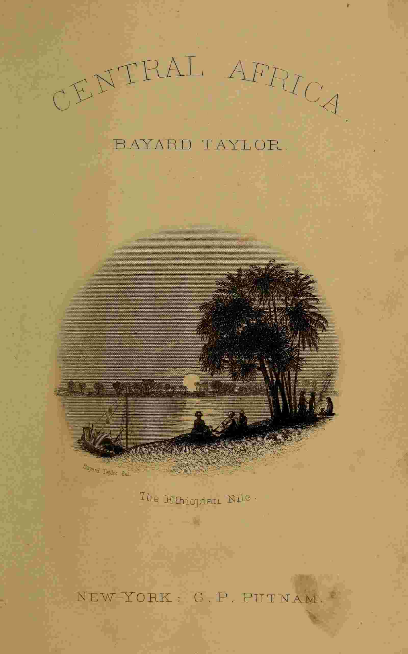
CHAPTER XXIII.
THE COUNTRIES OF SOUDÂN.
Recent Explorations of Soudân—Limit of the Tropical Rains—The Conquest of Ethiopia—Countries Tributary to Egypt—The District of Takka—Expedition of Moussa Bey—The Atbara River—The Abyssinian Frontier—Christian Ruins of Abou-Haràss—The Kingdom of Sennaar—Kordofan—Dar-Fūr—The Princess of Dar-Fūr in Khartoum—Her Visit to Dr. Reitz—The Unknown Countries of Central Africa
Until within a recent period, but little has been known of the geography and topography of the eastern portion of Central Africa. Few English travellers have made these regions the subject of their investigation, their attention having been principally directed towards the countries on the western coast. The Niger, in fact, has been for them a more interesting problem than the Nile. The German travellers Rüppell and Russegger, however, by their explorations within the last twenty-five years, have made important contributions to our knowledge of Eastern Soudân, while D’Arnaud, Werne, and more than all, Dr. Knoblecher, have carried our vision far into the heart of the mysterious regions beyond. Still, the results of these explorations are far from being generally known, or even represented upon our maps. Geographical charts are still issued, in which the conjectured Mountains of the Moon continue to stretch their ridges across the middle of Africa, in latitudes where the latest travellers find a plain as level as the sea. A few words, therefore, concerning the character and relative position of the different countries of which I have occasion to speak, may make these sketches of African life and landscapes more intelligible to many readers.
As far as southern Nubia, with the exception of the Oases in the Libyan Desert, the Nile is the only agent of productiveness. Beyond the narrow limits of his bounteous valley, there is little except red sand and naked rock, from the Red Sea to the Atlantic. On reaching lat. 19°, however, a change takes place in the desert landscapes. Here the tropical rains, which are unknown in Egypt and Northern Nubia, fall every summer, though in diminished quantity. The dry, gravelly plains, nevertheless, exhibit a scattering growth of grass and thorny shrubs, and springs are frequently found among the mountain ranges. As we proceed southward, the vegetation increases in quantity; the grass no longer keeps the level of the plain, but climbs the mountain-sides, and before reaching Khartoum, in lat. 15° 40′ north, we have passed the limit of the Desert. The wide plains stretching thence eastward to the Atbara, and westward beyond Kordofan, are savannas of rank grass, crossed here and there by belts of the thorny mimosa, and differing little in aspect from the plains of California during the dry season. The Arabs who inhabit them are herdsmen, and own vast flocks of camels and sheep. The Nile here is no longer the sole river, and loses his title of “The Sea,” which he owns in Egypt. The Atbara, which flows down to him from the Abyssinian Alps, has many tributaries of its own; the Blue Nile, between Khartoum and Sennaar receives the large streams of the Ràhad and the Dender; and the White Nile, though flowing for the greater part of his known course through an immense plain, boasts two important affluents—the Sobat and the Bahr el-Ghazàl. The soil, climate, productions and character of the scenery of this region are therefore very different from Egypt.
Before the conquest of Soudân by Mohammed Ali, little was known of the country between the Ethiopian Nile and the Red Sea, or of Central Africa south of the latitude of Kordofan and Sennaar. The White Nile, it is true, was known to exist, but was considered as a tributary stream. It was extremely difficult and dangerous to proceed beyond Nubia, and then only in company with the yearly caravans which passed between Assouan and Sennaar. Ibrahim Pasha, Ismaïl Pasha, and Mohammed Bey Defterdar, between the years 1820 and 1825, gradually subjugated and attached to the rule of Egypt the countries of Berber, Shendy and Sennaar, as far as the mountains of Fazogl, in lat. 11°, on the south-western frontier of Abyssinia, the wild domains of the Shukorees, the Bishàrees, the Hallengas and Hadendoas, extending to the Red Sea, and embracing the seaport of Sowakin, and the kingdom of Kordofan, west of the Nile, and bounded by the large and powerful negro kingdom of Dar-Fūr. The Egyptian possessions in Soudân are nearly as extensive as all Egypt, Nubia not included, and might become even richer and more flourishing under a just and liberal policy of government. The plains on both sides of the Nile might be irrigated to a much greater extent than in Egypt, and many vast tracts of territory given up to the nomadic tribes, could readily be reclaimed from the wilderness. The native inhabitants are infinitely more stupid and degraded than the Fellahs of Egypt, but that they are capable of great improvement is shown by the success attending the efforts of the Catholic priests in Khartoum, in educating children. The terrible climate of Soudân will always be a drawback to its physical prosperity, yet even this would be mitigated, in some measure, were the soil under cultivation.
As I followed the course of the Nile, from the northern limit of the tropical rains to Khartoum, my narrative will have given some idea of the country along his banks. The territory to the east, towards and beyond the Atbara, is still in a great measure unexplored. Burckhardt was the first European who visited it, but his route lay among the mountain-ranges near and parallel to the coast of the Red Sea. The long chain of Djebel Langay, which he crossed, is three to five thousand feet in height, and, like the mountain-spine of the island of Ceylon, never has the same season on both sides at once. When it rains on the eastern slopes, the western are dry, and the contrary. There is another and still higher chain near the coast, but the greater part of this region consists of vast plains, tenanted by the Arab herdsmen, and rising gradually towards the south into the first terraces of the table-land of Abyssinia. The land of the Shukorees and the Hallengas, lying on both sides of the Atbara, is called Belad el Takka. Dr. Reitz visited it during the summer of 1851, in company with the military expedition under Moussa Bey, and travelled for three or four weeks through regions where no European had been before him.
Leaving the town of Shendy, he travelled eastward for nine days over unbroken plains of grass, abounding with gazelles and hyenas, to a village called Goz Radjeb, on the Atbara River. This belongs to the Shukorees, against whom the expedition was in part directed. He then crossed the river, and travelled for two or three weeks through a broken mountain country, inhabited by the wandering races of the Hallenges and Hadendoas. The mountains, which were from two to three thousand feet in height, were crested with walls of naked porphyry rock, but their lower slopes were covered with grass and bushes, and peopled by myriads of apes. Between the ranges were many broad and beautiful valleys, some of which were inhabited. Here the vegetable and animal world was far richer than on the Nile. The Consul was obliged to follow the movements of the expedition, and therefore could not trace out any regular plan of exploration. After seeing just enough to whet his curiosity to penetrate further, Moussa Bey returned to Goz Radjeb. His route then followed the course of the Atbara, for a distance of one hundred and twenty miles, to the town of Sofie, on the Abyssinian frontier. The river, which is a clear and beautiful stream, has a narrow border of trees and underwood, and flows in a winding course through a region of low, grassy hills. By using the water for irrigation, the country, which is now entirely uncultivated, might be made very productive. The Shukorees possess immense herds of camels, and a hegin, or trained dromedary, which the Consul purchased from them, was one of the strongest and fleetest which I saw in Africa.
Near Sofie the savannas of grass give place to dense tropical forests, with a rank undergrowth which is often impenetrable. Here, in addition to the lion and leopard, which are common to all Soudân, the expedition saw large herds of the elephant and rhinoceros. The woods were filled with birds of brilliant plumage, and the vegetable world was rich and gorgeous beyond description. The Consul remained but a short time here, and then travelled westward to the town of Abou-Haràss on the Blue Nile, visiting on the way a curious isolated mountain, called Djebel Attesh. Near Abou-Haràss are the ruins of an ancient Christian town, probably dating from the fourth or fifth century, about which time Christianity, previously planted in Abyssinia, began to advance northward towards Nubia. The Consul obtained from the Governor of Abou-Haràss three iron crosses of a peculiar form, a number of beads which had belonged to a rosary, and a piece of incense—all of which were found in removing the bricks used to build the Pasha’s palace and other edifices in Khartoum. The room which I occupied during my stay in Khartoum was paved with the same bricks. These remains are in curious contrast with the pyramids of Meroë and the temples of Mesowuràt. The Christian and Egyptian Faiths, advancing towards each other, almost met on these far fields.
The former kingdom of Sennaar included the country between the two Niles—except the territory of the Shillooks—as far south as lat. 12°. It is bounded by Abyssinia on the east, and by the mountains of the savage Galla tribes, on the south. The Djezeereh (Island) el Hoye, as the country between the rivers is called, is for the most part a plain of grass. Towards the south, there are some low ranges of hills, followed by other plains, which extend to the unknown mountain region, and abound with elephants and lions. The town of Sennaar, once the capital of this region and the residence of its Meks or Kings, is now of little importance. It was described to me as a collection of mud huts, resembling Shendy. The Egyptian rule extends ten days’ journey further, to Fazogl, where the fine timber in the mountains and the gold-bearing sands of Kasan have given rise to the establishment of a military post Sennaar, as well as Kordofan, Berber and Dongola, is governed by a Bey, appointed by the Pasha of Soudân. It is only two weeks’ journey thence to Gondar, the capital of Amhara, the principal Abyssinian kingdom. I was told that it is not difficult for merchants to visit the latter place, but that any one suspected of being a person of consequence is detained there and not allowed to leave again. I had a strong curiosity to see something of Abyssinia, and had I been quite sure that I should not be taken for a person of consequence, might have made the attempt to reach Gondar.
Kordofan lies west of the White Nile, and consists entirely of great plains of grass and thorns, except in the southern part, where there is a mountain range called Djebel Dyer, inhabited by emigrants from Dongola. It is not more than two hundred miles in breadth, from east to west. Its capital, Obeid, lies in lat. 13° 12′ north, and is a mere collection of mud huts. Mr. Peterick, the English Vice-Consul for Soudân, to whom I had letters from Mr. Murray, the English Consul-General in Cairo, had taken up his residence in Obeid. The soil of Kordofan is sterile, and the water is considered very unhealthy for foreigners. Capt. Peel gave me such a description of its endless thickets of thorns, its miserable population and its devastating fevers, that I lost all desire to visit it. The Governor, Abd-el-Kader Bey, was in Khartoum, and Dr. Reitz intended making a journey through the country in company with him. There is a caravan route of twenty days between Obeid and Dongola, through a wild region called the Beyooda, or Bedjuda. A few degrees further north, it would be a barren desert, but here it is an alternation of wadys, or valleys, with ranges of porphyry mountains, affording water, trees, and sufficient grass for the herds of the wandering Arabs. It is inhabited by two tribes—the Kababish and the Howoweet, who differ strongly from the Arabs east of the Nile, in their appearance and habits. The latter, by their superior intelligence and their remarkable personal beauty, still attest their descent from the tribes of Hedjaz and Yemen. The tribes in the western desert are more allied to the Tibboos, and other tenants of the Great Zahara. The caravans on this road are exposed to the danger of attacks from the negroes of Dar-Fūr, who frequently waylay small parties, murder the individuals and carry off the camels and goods.
The great kingdom of Dar-Fūr offers a rich field for some future explorer. The extensive regions it incloses are supposed to furnish the key to the system of rivers and mountain-chains of Central Africa. Through the fear and jealousy of its rulers, no stranger has been allowed to pass its borders, since the visit of Mr. Browne, half a century ago. Of late, however, the relations between the Egyptian rulers in Soudân and the Sultan of Dar-Fūr have been quite amicable, and if nothing occurs to disturb this harmony there is some hope that the ban will be removed. Lattif Pasha informed me that he had written to the Sultan on behalf of Capt. Peel, who wished to pass through Dar-Fūr and reach Bornou. He had at that time received no answer, but it had been intimated, unofficially, that the Sultan would reply, giving Capt. Peel permission to enter the country and travel in it, but not to pass beyond it. There is an almost continual war between the Sultans of Bornou and Dar-Fūr, and the Pasha was of the opinion that it would be impossible to traverse Africa from east to west, in the line of those states.
A circumstance occurred lately, which may help to open Dar-Fūr to Europeans. The Sitteh (Lady) Sowakin, the aunt of Sultan Adah, the present monarch of that kingdom, is a zealous Moslem, and lately determined to make a pilgrimage to the grave of the Prophet. She arrived in Khartoum in August, 1851, attended by a large retinue of officers, attendants and slaves, and after remaining a few days descended the Nile to El Mekheyref, crossed the Desert to Sowakin, on the Red Sea, and sailed thence for Djidda, the port of Mecca. During her stay Lattif Pasha was exceedingly courteous to her, introducing her to his wives, bestowing upon her handsome presents, and furnishing her with boats and camels for her journey. Dr. Reitz availed himself of the occasion to make the people of Dar-Fūr better acquainted with Europeans. All the Frank residents assembled at his house, in Christian costume, and proceeded to the residence of the Lady Sowakin. They found her sitting in state, with two black slaves before her on their hands and knees, motionless as sphinxes. On each side stood her officers and interpreters. She was veiled, as well as her female attendants, and all exhibited the greatest surprise and curiosity at the appearance of the Franks. The gifts they laid before her—silks, fine soaps, cosmetics, bon-bons, &c.—she examined with childish delight, and when the Consul informed her that the only object of the Europeans in wishing to enter Dar-Fūr was to exchange such objects as these for gum and elephants’ teeth, she promised to persuade Sultan Adah to open his kingdom to them.
The next day her principal officers visited the Consul’s house, and spent a long time examining its various wonders. The pictures, books and furniture filled them with astonishment, and they went from one object to another, like children, uttering exclamations of surprise and delight. What most startled them was a box of lucifer matches, which was entirely beyond their comprehension. They regarded the match with superstitious awe, and seemed to consider that the fire was produced by some kind of magic. Their relation of what they saw so excited the curiosity of the Lady Sowakin, that she came on the following day, with her women. She was no less astonished than her attendants had been, but was most attracted by the Consul’s large mirror. She and her women spent half an hour before it, making gestures, and unable to comprehend how they were mimicked by the reflected figures. As she was unacquainted with its properties, she threw back her veil to see whether the image would show her face. The Consul was standing behind her, and thus caught sight of her features; she was black, with a strongly marked but not unpleasant countenance, and about forty-five years of age. He had a breakfast prepared for the ladies, but on reaching the room the attendants all retired, and he was informed that the women of rank in Dar-Fūr never eat in the presence of the men. After they had finished the repast, he observed that they had not only partaken heartily of the various European dishes, but had taken with them what they could not eat, so that the table exhibited nothing but empty dishes. When they left, the Lady reiterated her promise, and added that if the Consul would visit Dar-Fūr, the Sultan would certainly present him with many camel-loads of elephants’ teeth, in consideration of his courtesy to her.
To the westward of Dar-Fūr, and between that country and Bornou, lies the large kingdom of Waday, which has never been visited by a European. I learned from some Kordofan merchants, who had visited the frontiers of Dar-Fūr on their trading expeditions, that Sultan Adah had conquered a great part of Waday, and would probably soon become involved in war with the Sultan of Bornou. It is said that there is in the country of Waday a lake called Fittre, which is a hundred and fifty miles in length, and receives several rivers. At the south-western extremity of Dar-Fūr, in lat. 6° N. there is a small country, called Fertit. I often heard it mentioned by the Ethiopian traders, one of whom showed me a snuff-box, which he had bought of a native of the country. It was made from the hard shell of a fruit about the size of an orange, with a stopper roughly wrought of silver. Almost the entire region south of lat. 10° N. and lying between the White Nile and the Gulf of Guinea is unknown ground, and presents a rich field for future explorers.
The difficulties and dangers which have hitherto attended the path of African discovery, are rapidly diminishing, and the time is not far distant when every mystery, hidden in the heart of that wonderful Continent, will be made clear. Where a traveller has once penetrated, he smoothes the way for those who follow, and that superior intelligence which renders the brute creation unable to bear the gaze of a human eye, is the defence of the civilized man against the barbarian. Bruce, journeying from Abyssinia to Egypt, in the year 1772, was beset by continual dangers, and even Burckhardt, in 1814, though successfully disguised as a Mussulman shekh, or saint, was obliged to keep his journal by stealth. At present, however, a Frank may travel in comparative safety, from Cairo to the borders of Dar-Fūr and Abyssinia, while the White Nile and its tributaries afford avenues to the very heart of the unexplored regions beyond. The climate is the greatest obstacle in the way of discovery, and the traveller whose temperament is best adapted for the heats of the inter-tropical zone, possesses the best chance of success.