The Project Gutenberg eBook of Ancient Landscapes of the Grand Canyon Region
Title: Ancient Landscapes of the Grand Canyon Region
Author: Edwin D. McKee
Release date: January 31, 2015 [eBook #48126]
Most recently updated: October 24, 2024
Language: English
Credits: E-text prepared by Stephen Hutcheson, Dave Morgan, Carol Spears, and the Online Distributed Proofreading Team (http://www.pgdp.net)
The Project Gutenberg eBook, Ancient Landscapes of the Grand Canyon Region, by Edwin Dinwiddie McKee, Illustrated by Louis Schellbach and Russell Hastings
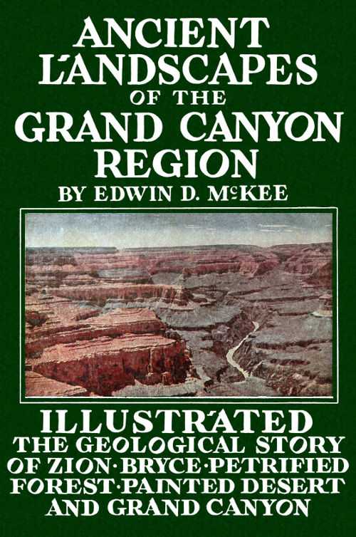
THE GRAND CANYON—1. SCHISTS AND GRANITES (ARCHEAN ERA):
2. SANDSTONES, LIMESTONES, SHALES (ALGONKIAN ERA): 3. TONTO FORMATIONS
(CAMBRIAN PERIOD): 4. REDWALL LIMESTONE (MISSISSIPPIAN
PERIOD): 5. SUPAI SANDSTONE AND SHALE (PERMIAN PERIOD):
6. HERMIT SHALE (PERMIAN PERIOD): 7. COCONINO SANDSTONE (PERMIAN
PERIOD): 8. TOROWEAP AND KAIBAB FORMATIONS (PERMIAN PERIOD).
NATIONAL PARK SERVICE
ANCIENT LANDSCAPES
OF THE
GRAND CANYON REGION
THE GEOLOGY OF GRAND CANYON, ZION, BRYCE, PETRIFIED FOREST & PAINTED DESERT
BY
Edwin D. McKee, Asst. Director
Museum of Northern Arizona
Sketches and Charts by Louis Schellbach 3rd Park Naturalist, Grand Canyon National Park, and Russell Hastings
PUBLISHED BY
EDWIN D. MCKEE
1931
COPYRIGHT 1931
Edwin D. McKee
Thirteenth Edition, 1952
PRINTED BY
COCONINO SUN CO.
Flagstaff, Arizona
TABLE OF CONTENTS
- PAGE
- Introduction ix
- Chapter I—The Archean Era 1
- The Earth’s Oldest Rocks, Grand Canyon 2
- Granite in Grand Canyon 4
- Chapter II—The Algonkian Era 5
- Algonkian Rocks in Grand Canyon 5
- Formation of Mountains 6
- Early Climates 6
- Oldest Known Life 7
- Chapter III—The Paleozoic Era 9
- First Animal Life—The Tonto Rocks 9
- The Missing Periods of the Third Era 11
- The Age of Fish 12
- Sea Life From the North—Redwall Limestone 12
- Tracks in the Supai Sandstone 14
- Landscapes of the Hermit Shale 15
- Wind-blown Sand—The Coconino Sandstone 17
- Warm Seas from the West—The Toroweap and Kaibab Formations 18
- Chapter IV—The Mesozoic Era 21
- Remnants of Younger Strata—Red Butte and Cedar Mountain 21
- The Petrified Forest 22
- Dinosaur Tracks—The Painted Desert 24
- The Rocks of Zion Canyon and Rainbow Natural Bridge 26
- From Seashells to Coalbeds 27
- Chapter V—The Cenozoic Era 29
- Bryce Canyon Formation 30
- A Great Erosion Surface 32
- Crustal Movement at Grand Canyon 33
- Cutting the Grand Canyon 34
- The Forming of Zion Canyon 37
- Glaciers 38
- San Francisco Mountain Volcanic Field 39
- Elephants and Camels 41
- Advent of Man in the Southwest 42
- Bibliography 45
ILLUSTRATIONS
- PAGE
- The Grand Canyon Frontispiece
- Diagrammatic Sections of Grand Canyon Region x
- Rocks of First Era, Inner Gorge of Grand Canyon 1
- Block Diagrams of Events of First Era 3
- Tilted Rocks of the Second Era, Grand Canyon 5
- Diagrammatic Section of Third Era Formations, Grand Canyon 8
- Scene on Cambrian Sea Floor in Grand Canyon Region 10
- Trilobites Preserved in Green Shale of Grand Canyon Walls 11
- A Fresh-water Fish of Devonian Age (Sketch) 12
- Sea Life from the Redwall, Grand Canyon (Sketches) 12
- Havasu Falls in Redwall Limestone, Grand Canyon 13
- Tracks of Short-legged, Prehistoric Animal, Supai Formation, Grand Canyon 14
- Landscape at Time Hermit Shale was Forming 15
- Fossil Fern From the Hermit Shale, Grand Canyon 15
- Wind-blown Sand, Coconino Formation, Grand Canyon 17
- Tracks of Primitive Four-footed Animals, Coconino Sandstone, Grand Canyon 17
- Marine Life From the Kaibab Limestone, Grand Canyon (Sketches) 18, 19
- Diagrammatic Section of Fourth Era Formations, Southern Utah and Painted Desert Regions 20
- Cedar Mountain 22
- Red Butte 22
- Petrified Forest, Arizona 23
- Petrified Logs of Triassic Age 23
- Dinosaur Tracks, Painted Desert 24
- The Painted Desert 25
- Zion Canyon, Navajo Sandstone 26
- Rainbow Natural Bridge, Navajo Sandstone 26
- Cretaceous Shells From Southern Utah (Sketches) 27
- Coal Canyon, Painted Desert Country 28
- Bryce Canyon 30
- Map of Colorado River 31
- A Great Erosion Surface 32
- Diagrammatic Cross Sections of Grand Canyon 35
- The Grand Canyon 36
- Zion Canyon 37
- Chart of San Francisco Mountains 39
- San Francisco Mountain—Past and Present (Sketch) 40
- Map of San Francisco Mountain Volcanic Field 40
- San Francisco Mountain 41
- Elephant and Camel Remains 42
- Ancient Indian Petroglyphs, Head of Bright Angel Trail, Grand Canyon 43
INTRODUCTION
Probably no place in the world of similar area has recorded a more complete or a more interesting resume of the earth’s history than has the high plateau country of northern Arizona and southern Utah. Although many great events and some long intervals of time are not represented by the formations of this region, yet of the five major chapters or eras into which all of time has been divided by geologists, at least some parts of each have left their traces in this area.
Whether on the brink of the mighty Grand Canyon, among beautiful logs of the Petrified Forest, or beneath the lofty walls of Zion—the “Rainbow of the Desert”—one looks upon rocks which are not alone curious or colorful, but which are also records of the past inscribed and illustrated in an intensely interesting manner. In one place is seen the sand of ancient dunes, in another the border of an early sea, or perhaps the floodplain of mighty rivers, and in all of these remain the unmistakable evidences of life—plants and animals preserved to make a reality of the living, moving past. Everywhere are found the evidences of those great processes of nature—erosion of the high country, land formation in the low country, and mighty crustal movements slowly raising or lowering the land in both.
From the rim of Grand Canyon one not only looks down through tremendous space, but also through time, glimpsing the record of vast ages, measurable not in centuries but in millions and even hundreds of millions of years. There in the bottom of that mighty chasm are found rocks formed during the first and oldest era—rocks in which the original structure has been entirely modified by great heat and pressure and in which no evidence of life has been found. There in the Grand Canyon are also seen two other great series of rocks, those of the second era which are partially altered and which contain earliest traces of plants, and those of the succeeding era in which are preserved primitive animals of many types.
Rocks of the fourth great era—the age of dinosaurs—lend color to the Painted Desert, and to the sheer walls of Zion Canyon. Beautiful little Bryce Canyon to the north boasts of some of the most recently formed rocks in the region—those of the fifth and last era, the age of mammals. The great volcanic mountains and the marvelous features of erosion, such as the canyons and the desert cliffs, are also developments of this most recent chapter. In brief, the Grand Canyon region affords some wonderfully interesting glimpses of ancient landscapes during many different parts of the earth’s history, and these make the past a moving, living thing.
CHAPTER I
THE ARCHEAN ERA
ROCKS OF FIRST ERA. INNER GORGE OF GRAND CANYON
THE EARTH’S OLDEST ROCKS
(THE ARCHEAN ERA)
Looking into the depths of Grand Canyon from any point within the Bright Angel section, one is immediately impressed by the narrow V-shaped gorge cut in the black rocks at the bottom. This is popularly termed the Granite or Inner Gorge. Within its walls one is in another world, both scenically and geologically. Their steep, bare sides, whose surfaces are chaotic in the extreme, have a history—long and complex. The rocks of which they are formed—some of the oldest known today on the surface of the earth—partially tell the story of the first great era in geologic history.
Other rocks of this, the Archean age, are found in the Rockies, in the Adirondacks of New York, and to a very great extent in eastern Canada. In the last named place they contain valuable deposits of iron, nickel, cobalt, and copper. Rocks which probably also correspond in age occur in Scandinavia, Brazil, China, India, and central Africa.
At the Grand Canyon, although we are impressed by the depth of the dark Archean rocks, beneath the plateau surface approximately a mile, yet we marvel even more when we contemplate their great age and the important series of events whose history they partially record. Built up originally as great horizontal deposits of sand and mud, they were bent by mighty crustal movements until high mountains, probably comparable to the present Alps, were formed. Pressures from the northwest and southeast apparently folded them. The rocks themselves were greatly compressed and heated, with the result that complete recrystallization and the development of a banded structure were brought about. The present vertical attitude of these ancient beds, together with their dense crystalline character, is evidence of the great depth at which they were formed and of the extreme pressures to which they were subjected. In brief, the rocks that we see today in the Canyon bottom represent merely the roots of once lofty mountains, and the flat surface cut on these rocks is an old plain that resulted from the wearing down of high country in this region.
BLOCK DIAGRAMS OF EVENTS OF FIRST ERA
1 Sands and Muds accumulated to form rock strata.
2 The strata were folded into high mountains. Heat and pressure changed both structure and composition of the lower rocks during the folding.
3 Molten masses were forced up into cracks from below. Upon cooling they formed lavas on the surface and granites beneath.
4 During a tremendously long period of time the rivers and rains slowly widened the valleys and wore down the ancient mountains to a great plain near sea level.
As yet no definite traces of either plant or animal life have been found in rocks of the Archean age in Grand Canyon. Though various forms of life may have existed then, and may have been preserved in the original rocks, their record has since been entirely removed by those extreme pressures which altered even the composition and structure of the rocks themselves.
GRANITE IN GRAND CANYON
(THE ARCHEAN ERA)
Within the black, crystalline rocks of the Inner Gorge may be seen many large streaks, bands or irregular masses of a lighter color. From the Canyon rim these appear white, but from nearby they are usually pink. These light colored rocks are granites with a coarse crystalline texture.
Granites derive their name from their granular texture. They are formed by the slow cooling of molten masses that have been forced into older rocks from the earth’s interior. From a similar source are formed lavas and volcanic ash, but these flow out or are ejected on the surface of the earth where they cool so rapidly that no crystals form. Exceptionally fast cooling or chilling of molten masses, moreover, forms volcanic glass or obsidian. It is by the application of this same principle that crystal forming is prevented in the manufacture of common glass.
The large size of the crystals forming the granite that fills cracks and fissures of the Inner Gorge at Grand Canyon indicates the considerable depth at which it was formed and is further evidence of the great mountains that existed in this region during the first era in geologic history.
CHAPTER II
THE ALGONKIAN ERA
TILTED ROCKS OF THE SECOND ERA. GRAND CANYON
Rocks formed during the second great era of the earth’s history are distinctive in several respects. They are not highly altered or completely changed in form and structure as are those of the oldest era, but are largely free from such changes and, for the most part, similar to rocks which are seen in the process of formation today. Furthermore, they are known to contain definite traces of plant life, though no certain forms of animal life have yet been found in them. They represent a period probably as great as all of subsequent time.
ALGONKIAN ROCKS IN GRAND CANYON
Along Bright Angel Canyon and in several other places in the Grand Canyon, rocks of Algonkian age, representing accumulations of sediments several thousand feet in thickness, are found. Below and to the north of Desert View (southeast of Cape Royal on the North Rim) they form the open floor of the Canyon. Everywhere the most conspicuous layer of this series is a mud rock of brilliant vermilion color. However, the rocks also include a conglomerate or pebble layer, a dark limestone formed principally by plants, and a purple quartzite made by the consolidation of the grains of a sandstone.
FORMATION OF MOUNTAINS
(THE ALGONKIAN ERA)
The Algonkian rocks of the Grand Canyon region were bent and broken into mountains at an early date. In many places sloping layers showing the steep angle at which they were tilted are easily visible, even from the Canyon rim. Folded areas and strata which have been shattered are also conspicuous features here and there. The mountains which they formed, however, are now missing for they were worn away in large measure by slow erosion. Today only remnants—small hills on a general level surface—remain in the lower parts of Grand Canyon to tell the story.
EARLY CLIMATES
(THE ALGONKIAN ERA)
The rocks of Algonkian age are roughly estimated to be at least six or seven hundred million years old, yet from all indications they were formed under conditions of climate not unlike those of far later periods of history. In several parts of the world traces of great ice sheets—glaciers which scratched and eroded the surface—are found preserved in Algonkian rocks. In other places, including the Grand Canyon, ancient flows of lava are found where they gushed out upon the surface of an old land mass. Among the rocks below Desert View (Navajo) Point and bordering on the Colorado River may readily be seen several black cliffs formed by the volcanic activity of this early age.
The brilliant red shales of Algonkian age found in the lower parts of the Grand Canyon were formed as muds, accumulated probably by large rivers. In these muds are found preserved great quantities of ripple marks, indications of changing currents, also the moulds of salt crystals, and large shrinkage cracks resulting from a very hot sun. In brief, these criteria point toward a hot and probably arid climate in this region during that chapter of history.
OLDEST KNOWN LIFE
(THE ALGONKIAN ERA)
The oldest forms of life represented in rocks of Grand Canyon are found in strata of the Second, or Algonkian, Era. Certain layers of limestone showing peculiar structural patterns on their surfaces are interpreted as being the reefs built up through the activities of primitive one-celled plants known as algae. Similar structures are being formed today by plants of this type. Near Harper’s Ferry, West Virginia, for example, algae are building up limestone layers almost identical to the fossil ones found in the Algonkian rocks of Grand Canyon. In this connection, it is interesting to note that because of this similarity of the present to the past, the reality of the ancient plant structures was recognized a few years ago. They were discovered at a place in the Grand Canyon just west of the mouth of Bright Angel Creek.
Rocks of the Third Era in the Grand Canyon
- Rocks of the Fourth Era (Red Butte)
- Rim of Grand Canyon
- a~ Sandy limestone formed beneath the sea. In it are found corals, sponges, sharks’ teeth and many sea shells.
- Kaibab Formation 300 ft. Permian Age
- b~ Red sandstone and gray limestone. Formed at bottom of a shallow sea.
- Toroweap Formation 250 ft. Permian Age
- c~ Wind-blown sand which was piled in dunes. Contains the tracks of many kinds of primitive reptiles or amphibians.
- Coconino Sandstone 300 ft. Permian Age
- d~ River mud in which are preserved many impressions of ferns and cone-bearing plants, insect wings, raindrop pits and tracks of salamander-like animals.
- Hermit Shale 300 ft. Permian Age
- e~ Ancient flood-plain deposits of sand and mud containing impressions of fern-like plants and tracks of land animals.
- Supai Formation 800 ft. Permian Age
- f~ Sea deposits containing remains of shells, fish, sea-lillies and related forms of life.
- Redwall Limestone 550 ft. Mississippian Age
- g~ Accumulations of sandy lime in which are preserved the remains of some of the earliest fish.
- Temple Butte Limestone Devonian Age
- h~ Sand, muds, and limes representing ancient beach which was gradually covered with water until finally the sediments were at a considerable depth beneath the sea. The earliest definite traces of animal life in the canyon found here.
- Tonto Rocks Cambrian Age
- i and j rocks of the First and Second Era
CHAPTER III
THE PALEOZOIC ERA
It was during the third or middle chapter in the earth’s history that all of the apparently horizontal, upper layers in the Grand Canyon walls were formed. As will be seen in the succeeding pages, some of these rocks are sandstones formed from the sands of early beaches or sand dune areas, others are shales—the hardened muds of ancient river deltas—and still others are limestones built up by accumulations of plant and animal remains on sea bottoms. All are rocks formed by the deposition of sediments by wind and water during vast intervals of time. In them have been hidden and preserved many forms of life. Seashells, footprints, fern impressions, and various other traces of early plants and animals remain to tell the story of these ancient times. It is of special interest to note that in rocks formed during the earliest part of this chapter are found the first definite traces of animal life, that in other rocks of this chapter have been found evidences of primitive fish, and that in the most recent rocks of this group occur the traces of early reptiles, insects, ferns, and cone-bearing plants. In the walls of Grand Canyon examples of all of these fossils have been found, and these will be described in detail in the succeeding pages.
FIRST ANIMAL LIFE—THE TONTO ROCKS
(CAMBRIAN PERIOD)
Great highlands which were formed in the Grand Canyon region during the Second Era of history were afterwards gradually worn away by erosion until near the start of the next era a flat, almost featureless plain existed. Here and there, however, isolated hills of dark, crystalline rocks of the First Era stood above the general surface, as seen opposite Yaki point. In other places, such as to the west of where Bright Angel Creek now flows, small mountains of red Algonkian rocks (Second Era) remained. Around and against these, sediments were then deposited. Pebbles and sands accumulated, forming a thick layer which today appears as the brown sandstone rim of the Inner Gorge. These represent the first deposits of the Third Era. But the sea was encroaching upon the land during this period, and gradually the sand deposited near shore was covered by mud and this in turn by lime far out from the beach. Today this series of sand, mud and lime is found represented in the rocks of the Tonto Platform in Grand Canyon.
SCENE ON CAMBRIAN SEA FLOOR IN GRAND CANYON REGION (RECONSTRUCTION. MUSEUM NORTHERN ARIZONA)
Along the Tonto Trail a few hundred yards east of Indian Gardens numerous primitive sea animals have been found buried and preserved in layers of thin shale. Many of these are creatures with rounded shells smaller than the nail of a person’s little finger, others are animals related to the snail, and still others are crab-like creatures known as trilobites. The trilobites undoubtedly were the rulers of that age for they excelled not only in numbers but in size. Some specimens from Grand Canyon have measured over three inches in length. Despite this size, however, the trilobites and their associates from the Tonto Platform represent some of the earliest known forms of animal life.
TRILOBITES PRESERVED IN GREEN SHALE OF GRAND CANYON WALLS (ONE-EIGHTH NATURAL SIZE)
THE MISSING PERIODS OF THE THIRD ERA
(ORDOVICIAN AND SILURIAN PERIODS)
The geologist has found that two long periods of history are lacking in the great succession of ages represented by the strata in the Grand Canyon walls. These missing periods which belong to the Third Era are known as the Ordovician, the time when fish first appeared in the seas, and the Silurian, the time when millipeds and scorpions became our first air breathers. These ages immediately followed the Cambrian and involved millions of years. The absence of the first of them is explained by some geologists as the result of its rocks having been completely worn away at a later time. It seems more probable, however, that the Grand Canyon region was above sea level during these two ages so that no sediments were accumulated and consequently no rocks formed.
THE AGE OF FISH
(DEVONIAN PERIOD)
A FRESH WATER FISH OF DEVONIAN AGE
During that period of geologic time commonly known as the “age of fish,” sands and limes were accumulated on the surface of the Grand Canyon region filling in old river channels and burying the bodies of fish and other animals. The deposits formed at this time were later eroded to a large extent. The surface of the land was worn and washed away until finally only isolated patches or pockets of limestone and sandstone remained. These we find today exposed in the walls of the Grand Canyon occurring just at the base of the great Redwall cliff in about fifteen different localities.
Although fish were rulers of the age during Devonian times, they were of primitive types and apparently depended for defense upon bony skin armour rather than upon speed. The plates and scales of fresh-water fish have been found preserved in the lavender rocks of this age in the Grand Canyon.
SEA LIFE FROM THE NORTH—THE REDWALL LIMESTONE
(MISSISSIPPIAN OR LOWER CARBONIFEROUS PERIOD)
REDWALL FOSSILS (NATURAL SIZE)
One of the most prominent and conspicuous features of the Grand Canyon is the great red cliff of limestone about midway in its walls. This cliff is the highest in the Canyon—averaging about 550 feet in the area of Bright Angel Canyon. In most places it is almost vertical, and in some it even overhangs to such an extent that a visitor once aptly said, “The Washington Monument might be placed beneath it and kept out of the rain.”
To the prospector this formation is known as the Blue Lime; to the geologist it is the Redwall Limestone. Both are correct. Actually the rock is a rather pure limestone of a grey or bluish color, but in most places where seen, its surface has been stained a bright red by iron oxides from above. It appears throughout the Grand Canyon as a wide band or ribbon of red.
HAVASU FALLS IN REDWALL LIMESTONE. GRAND CANYON
Large amphitheaters, many curving alcoves, caves, and solution tunnels are all characteristic features of the great Redwall. It is composed of relatively pure lime so rain and other waters have a chemical action upon it—they leach and dissolve it. Waters all tend to drain toward curving centers, and so increase this curving. Everywhere the rounding off of corners takes place.
The origin of the Redwall Limestone is as interesting as its form. The purity of the lime indicates that it was built up in a relatively wide and quiet sea. Its composition represents a vast accumulation of the skeletons of ancient plants and animals. Seashells are found in great numbers, some of them preserved in delicate detail. These and other forms of ocean life clearly indicate that a great sea connection then existed between this region and that of western Canada to the north.
TRACKS IN THE SUPAI SANDSTONE
(PERMIAN PERIOD)
During that period in geological history known as the Permian, when some of the beds of soft coal in eastern America were being formed, a large area in northern Arizona was receiving red sediments from the east, probably carried by rivers from the granitic highlands of that region. Today these sediments appear in the Grand Canyon walls as alternating layers of red sandstone and shale immediately above the great Redwall. They are almost a thousand feet in thickness.
TRACKS OF SHORT-LEGGED PREHISTORIC ANIMAL. SUPAI FORMATION. GRAND CANYON
When the red beds were accumulating in this region, the climate probably was more or less arid; the vegetation consisted principally of ferns and other lowly plants; and the animal life included a group of large but primitive four-footed creatures. Numerous tracks of the latter, preserved in the walls of Grand Canyon, have provided one of the most interesting discoveries of recent years. Some of these footprints are several inches in length, and the number of toes varies between three and five. They show no close relationship to the tracks of other localities, and apparently represent a fauna new to North America.
LANDSCAPES OF THE HERMIT SHALE
(PERMIAN PERIOD)
LANDSCAPE AT TIME HERMIT SHALE WAS FORMING (RECONSTRUCTION. MUSEUM NORTHERN ARIZONA)
FOSSIL FERN FROM THE HERMIT SHALE (REDUCED)
Concerning the conditions under which the topmost red formation of the Grand Canyon (the Hermit Shale) was developed, and the nature of its origin, we have today a rather definite and interesting picture. A wealth of fossil plants and a number of tracks of animals have been found excellently preserved in its muddy layers, and by means of these and other indications the following conclusions have been drawn.
The Hermit Shale represents accumulations of mud and fine sandy material deposited probably by streams flowing from the northeast. Here and there are found evidences of pools and arroyos with wavy ripple marks on their borders and a thin film of shiny slime covering the surface. The trails of worms, the footprints of small salamander-like animals, and the fronds of ferns, mostly mascerated or wilted, are found delicately preserved in this slime. Raindrop impressions, the molds of salt crystals and numerous sun-cracks also add to the picture. This region has been described by Dr. David White as “the scene of showers, burning sun, hailstorms, occasional torrents and periods of drought and drying up of pools” during Hermit times.
Thirty-five species of plants are at present known from the Hermit Shale of Grand Canyon. Many of these have not been found elsewhere in the world, though some were representatives of European plants, and others had their closest relations in central Asia, India, Australia, Africa, and South America. This fossil flora consists principally of ferns and small cone-bearing plants, all of which were relatively dwarfed in size and appear less dense than those of corresponding age found in eastern America. They apparently indicate a semi-arid climate with long dry seasons, for the absence of moist-climate and swamp-loving types is noticeable.
Several insect wings have been found in the Hermit Shale, one of which was four inches in length. Numerous footprints of vertebrate animals have also been found, and undoubtedly represent an interesting fauna.
WIND-BLOWN SAND—THE COCONINO
(PERMIAN PERIOD)
The light-colored formation which appears as a conspicuous ribbon-like band around the upper part of the Grand Canyon has long presented a puzzle concerning its origin. The grains of white sand of which it is composed apparently were deposited at steep angles, for the many and varied slopes which were formed may be readily seen today on the surface of the rock. These slopes were probably once the lee sides of sand dunes deposited by winds in an area bordering the sea. We find the only traces of life in this formation represented by the trails of ancient worms and insects, and by the foot-prints of early lizard, or salamander-like creatures. Already the tracks of some 27 species of animals have been discovered in this sandstone within the Grand Canyon, though strangely enough no bones have yet been located.
WIND-BLOWN SAND. COCONINO FORMATION. GRAND CANYON
TRACKS OF PRIMITIVE FOUR-FOOTED ANIMALS, COCONINO SANDSTONE. GRAND CANYON PHOTO BY E. W. ENSOR
WARM SEAS FROM THE WEST—THE TOROWEAP AND KAIBAB FORMATIONS
(PERMIAN PERIOD)
SEASHELLS FROM KAIBAB LIMESTONE (REDUCED)
Along both sides of Grand Canyon at the top, two buff and gray layers of limestone stand out as massive cliffs separated by a tree-covered slope. The upper of these limestones forms the plateau surface and may be seen for a great distance in every direction. Both layers were formed as the result of vast accumulations of organic and sandy materials on sea bottoms, and in places are composed largely of the remains of marine life—shells, corals and sponges. The teeth of sharks have also been found in the upper limestone.
SEA LILY OR CRINOID (REDUCED)
HORN CORAL (NATURAL SIZE)
During the early stages of the period when these marine animals lived and multiplied in the region, a great body of salt water extended over its surface from far to the west, remained briefly, then retreated from the area. Soon, however, marine waters advanced once more and another sea was formed with its shoreline extending eastward even beyond the region in which we now find Grand Canyon. Evidences of the second and larger sea are found beyond Flagstaff to the south, in the Painted Desert to the east, and almost to Zion Canyon to the north.
The presence of corals and sharks’ teeth not only indicates that this region was covered on more than one occasion by marine waters, but also suggests that these seas were warm and shallow. This is estimated to have been some 200 million years ago.
FOSSIL SHARK’S TOOTH (NATURAL SIZE)
ROCKS OF THE FOURTH ERA
The Painted Desert and Zion Canyon Region
CHAPTER IV
THE MESOZOIC ERA
The Fourth Chapter of the earth’s history is commonly known as “the age of dinosaurs.” Large reptiles were the dominating forms of life all over the world during this age. Landscapes and types of climate varied considerably, and in the Grand Canyon region they changed completely several times. During some periods ocean bodies covered the country; at others desert winds piled up dunes on the surface. Again this region was the flood plain of rivers, where pebbles, mud and great logs of pine were washed in and deposited. At still other times coal was formed in some quantity. All of these interesting features of the Fourth Chapter will be briefly treated in the pages following. Their records as found at Zion Canyon to the north, in the Painted Desert to the east, and at the Petrified Forest to the south are such that a visitor to the region can scarcely help but marvel and wonder at their meaning.
REMNANTS OF YOUNGER STRATA—RED BUTTE AND CEDAR MOUNTAIN
(MOENKOPI FORMATION: TRIASSIC PERIOD)
Two isolated hills of unusual interest rise above the plateau surface near Grand Canyon. Looking east from Desert View (Navajo) Point one of these, a flat-topped mesa called Cedar Mountain, may be seen. The other, known as Red Butte, is a rounded hill about fifteen miles to the south of Grand Canyon village. The most interesting feature of these hills is found in the fact that they are composed for the most part of red sandstones and shales which once formed a continuous layer over this entire plateau region. These same rocks are found throughout southern Utah to the north, and in the Painted Desert to the east. Except at Red Butte and Cedar Mountain they have been completely stripped off and eroded away from the vicinity of Grand Canyon. The time involved in this erosion was tremendous and the consequences widespread. As a result the present flat plateau surface was formed—a great plain high above sea level. The persistence of Red Butte and Cedar Mountain against time and the elements is easily explained, moreover, by the hard lava cap of the former and the protecting layer of pebble-rock on top of the latter.