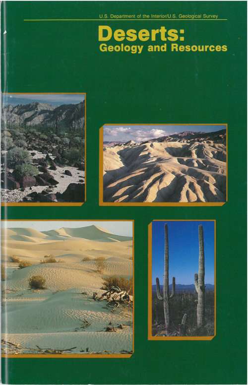
The Project Gutenberg eBook of Deserts: Geology and Resources
Title: Deserts: Geology and Resources
Author: A. S. Walker
Release date: October 14, 2014 [eBook #47108]
Most recently updated: October 24, 2024
Language: English
Credits: Produced by Stephen Hutcheson, Dave Morgan and the Online
Distributed Proofreading Team at http://www.pgdp.net
U. S. Department of the Interior / U. S. Geological Survey
Deserts:
Geology and Resources
by A. S. Walker
Great Sand Dunes National Monument, Colorado (photograph by John Keith).
Beauty is before me
And beauty behind me,
Above and below me hovers the beautiful,
I am surrounded by it,
I am immersed in it.
In my youth I am aware of it,
And in old age
I shall walk quietly
The beautiful trail.
from a Navajo benedictory chant describing the desert
Cacti dominate the Sonoran Desert vegetation near Tucson, Arizona (photograph by Peter Kresan).
What Is a Desert?
Approximately one-third of the Earth’s land surface is desert, arid land with meager rainfall that supports only sparse vegetation and a limited population of people and animals. Deserts—stark, sometimes mysterious worlds—have been portrayed as fascinating environments of adventure and exploration from narratives such as that of Lawrence of Arabia to movies such as “Dune.” These arid regions are called deserts because they are dry. They may be hot, they may be cold. They may be regions of sand or vast areas of rocks and gravel peppered with occasional plants. But deserts are always dry.
Ripples on a dune in the Gran Desierto, Mexico (photograph by Peter Kresan).
Deserts are natural laboratories in which to study the interactions of wind and sometimes water on the arid surfaces of planets. They contain valuable mineral deposits that were formed in the arid environment or that were exposed by erosion. Because deserts are dry, they are ideal places for human artifacts and fossils to be preserved. Deserts are also fragile environments. The misuse of these lands is a serious and growing problem in parts of our world.
DISTRIBUTION OF NON-POLAR ARID LAND (after Meigs, 1953)
There are almost as many definitions of deserts and classification systems as there are deserts in the world. Most classifications rely on some combination of the number of days of rainfall, the total amount of annual rainfall, temperature, humidity, or other factors. In 1953, Peveril Meigs divided desert regions on Earth into three categories according to the amount of precipitation they received. In this now widely accepted system, extremely arid lands have at least 12 consecutive months without rainfall, arid lands have less than 250 millimeters of annual rainfall, and semiarid lands have a mean annual precipitation of between 250 and 500 millimeters. Arid and extremely arid land are deserts, and semiarid grasslands generally are referred to as steppes.
Gran Desierto of the Sonoran Desert, Mexico. Surrounding the dark 25-kilometer-long and 5-kilometer-wide Sierra del Rosario mountains (upper right) are dunes and sheets of sand.
How the Atmosphere Influences Aridity
We live at the bottom of a gaseous envelope—the atmosphere—that is bound gravitationally to the planet Earth. The circulation of our atmosphere is a complex process because of the Earth’s rotation and the tilt of its axis. The Earth’s axis is inclined 23½° from the ecliptic, the plane of the Earth’s orbit around the Sun. Due to this inclination, vertical rays of the Sun strike 23½° N. latitude, the Tropic of Cancer, at summer solstice in late June. At winter solstice, the vertical rays strike 23½° S. latitude, the Tropic of Capricorn. In the Northern Hemisphere, the summer solstice day has the most daylight hours, and the winter solstice has the fewest daylight hours each year. The tilt of the axis allows differential heating of the Earth’s surface, which causes seasonal changes in the global circulation.
The circulation pattern of the Earth’s atmosphere. Most of the nonpolar deserts lie within the two trade winds belts.
On a planetary scale, the circulation of air between the hot Equator and the cold North and South Poles creates pressure belts that influence weather. Air warmed by the Sun rises at the Equator, cools as it moves toward the poles, descends as cold air over the poles, and warms again as it moves over the surface of the Earth toward the Equator. This simple pattern of atmospheric convection, however, is complicated by the rotation of the Earth, which introduces the Coriolis Effect.
To appreciate the origin of this effect, consider the following. A stick placed vertically in the ground at the North Pole would simply turn around as the Earth rotates. A stick at the Equator would move in a large circle of almost 40,000 kilometers with the Earth as it rotates.
The Coriolis Effect illustrates Newton’s first law of motion—a body in motion will maintain its speed and direction of motion unless acted on by some outside force. Thus, a wind travelling north from the equator will maintain the velocity acquired at the equator while the Earth under it is moving slower. This effect accounts for the generally east-west direction of winds, or streams of air, on the Earth’s surface. Winds blow between areas of different atmospheric pressures.
The Coriolis Effect influences the circulation pattern of the Earth’s atmosphere. In the zone between about 30° N. and 30° S., the surface air flows toward the Equator and the flow aloft is poleward. A low-pressure area of calm, light variable winds near the equator is known to mariners as the doldrums.
Around 30° N. and S., the poleward flowing air begins to descend toward the surface in subtropical high-pressure belts. The sinking air is relatively dry because its moisture has already been released near the Equator above the tropical rain forests. Near the center of this high-pressure zone of descending air, called the “Horse Latitudes,” the winds at the surface are weak and variable. The name for this area is believed to have been given by colonial sailors, who, becalmed sometimes at these latitudes while crossing the oceans with horses as cargo, were forced to throw a few horses overboard to conserve water.
The surface air that flows from these subtropical high-pressure belts toward the Equator is deflected toward the west in both hemispheres by the Coriolis Effect. Because winds are named for the direction from which the wind is blowing, these winds are called the northeast trade winds in the Northern Hemisphere and the southeast trade winds in the Southern Hemisphere. The trade winds meet at the doldrums. Surface winds known as “westerlies” flow from the Horse Latitudes toward the poles. The “westerlies” meet “easterlies” from the polar highs at about 50-60° N. and S.
Near the ground, wind direction is affected by friction and by changes in topography. Winds may be seasonal, sporadic, or daily. They range from gentle breezes to violent gusts at speeds greater than 300 kilometers/hour.
These dunes in the Algodones Sand Sea of southeastern California move as much as 5 meters per year. The dunes in this photograph, looking south, move toward the east (left) (photograph by Peter Kresan).
Searles Lake, California (photograph courtesy of Kerr-McGee, Inc.).
Where Deserts Form
Dry areas created by global circulation patterns contain most of the deserts on the Earth. The deserts of our world are not restricted by latitude, longitude, or elevation. They occur from areas close to the poles down to areas near the Equator. The People’s Republic of China has both the highest desert, the Qaidam Depression that is 2,600 meters above sea level, and one of the lowest deserts, the Turpan Depression that is 150 meters below sea level.
Deserts are not confined to Earth. The atmospheric circulation patterns of other terrestrial planets with gaseous envelopes also depend on the rotation of those planets, the tilts of their axes, their distances from the Sun, and the composition and density of their atmospheres. Except for the poles, the entire surface of Mars is a desert. Venus also may support deserts.
The Garlock fault, near the bottom of this Landsat image, is generally considered to be the geologic border between the Mojave Desert in the south and the Great Basin Desert in the north. The Great Basin contains more than 150 discrete desert basins separated by more than 160 mountain ranges.
Types of Deserts
Deserts are classified by their geographical location and dominant weather pattern as trade wind, midlatitude, rain shadow, coastal, monsoon, or polar deserts. Former desert areas presently in nonarid environments are paleodeserts, and extraterrestrial deserts exist on other planets.
Trade wind deserts
The trade winds in two belts on the equatorial sides of the Horse Latitudes heat up as they move toward the Equator. These dry winds dissipate cloud cover, allowing more sunlight to heat the land. Most of the major deserts of the world lie in areas crossed by the trade winds. The world’s largest desert, the Sahara of North Africa, which has experienced temperatures as high as 57° C, is a trade wind desert.
Midlatitude deserts
Midlatitude deserts occur between 30° and 50° N. and S., poleward of the subtropical high-pressure zones. These deserts are in interior drainage basins far from oceans and have a wide range of annual temperatures. The Sonoran Desert of southwestern North America is a typical midlatitude desert.
Rain shadow deserts
Rain shadow deserts are formed because tall mountain ranges prevent moisture-rich clouds from reaching areas on the lee, or protected side, of the range. As air rises over the mountain, water is precipitated and the air loses its moisture content. A desert is formed in the leeside “shadow” of the range.
The Sahara of Africa is the world’s largest desert. It contains complex linear dunes that are separated by almost 6 kilometers (Skylab photograph).
A rare rain in the Tengger, a midlatitude desert of China, exposes ripples and a small blowout on the left. Winds will shortly cover or remove these features.
This Landsat image shows the Turpan Depression in the rain shadow desert of the Tian Shan of China. A sand sea is in the lower center on the right, but desert pavement, gray in color, dominates this desert. The few oases in the desert and the vegetation in the mountains at the top are in red. A blanket of snow separates the vegetation in the Tian Shan from the rain shadow desert.
Coastal deserts
Coastal deserts generally are found on the western edges of continents near the Tropics of Cancer and Capricorn. They are affected by cold ocean currents that parallel the coast. Because local wind systems dominate the trade winds, these deserts are less stable than other deserts. Winter fogs, produced by upwelling cold currents, frequently blanket coastal deserts and block solar radiation. Coastal deserts are relatively complex because they are at the juncture of terrestrial, oceanic, and atmospheric systems. A coastal desert, the Atacama of South America, is the Earth’s driest desert. In the Atacama, measurable rainfall—1 millimeter or more of rain—may occur as infrequently as once every 5-20 years.
Crescent-shaped dunes are common in coastal deserts such as the Namib, Africa, with prevailing onshore winds. Low clouds cover parts of the Namib in this space shuttle photo.
High dunes of the Namib Desert near Sossus Vlei (photograph by Georg Gerster).
Morning fog moistens the dunes of the Namib coastal desert (photograph by Georg Gerster).
Monsoon deserts
“Monsoon,” derived from an Arabic word for “season,” refers to a wind system with pronounced seasonal reversal. Monsoons develop in response to temperature variations between continents and oceans. The southeast trade winds of the Indian Ocean, for example, provide heavy summer rains in India as they move onshore. As the monsoon crosses India, it loses moisture on the eastern slopes of the Aravalli Range. The Rajasthan Desert of India and the Thar Desert of Pakistan are parts of a monsoon desert region west of the range.
The Indus River floodplain, lower left, is the western border of the Thar Desert. This Landsat image of the monsoon desert shows small patches of sand sheets in the upper right, with three types of dunes; some dunes are almost 3 kilometers long.
Polar deserts
Polar deserts are areas with annual precipitation less than 250 millimeters and a mean temperature during the warmest month of less than 10° C. Polar deserts on the Earth cover nearly 5 million square kilometers and are mostly bedrock or gravel plains. Sand dunes are not prominent features in these deserts, but snow dunes occur commonly in areas where precipitation is locally more abundant.
Temperature changes in polar deserts frequently cross the freezing point of water. This “freeze-thaw” alternation forms patterned textures on the ground, as much as 5 meters in diameter.
The Dry Valleys of Antarctica have been ice-free for thousands of years (courtesy of USGS Image Processing Facility, Flagstaff, Arizona).
Paleodeserts
This aerial photograph of the Nebraska Sand Hills paleodesert shows a well-preserved crescent-shaped dune (or barchan) about 60 to 75 meters high (photograph by Thomas S. Ahlbrandt).
Data on ancient sand seas (vast regions of sand dunes), changing lake basins, archaeology, and vegetation analyses indicate that climatic conditions have changed considerably over vast areas of the Earth in the recent geologic past. During the last 12,500 years, for example, parts of the deserts were more arid than they are today. About 10 percent of the land between 30° N. and 30° S. is covered now by sand seas. Nearly 18,000 years ago, sand seas in two vast belts occupied almost 50 percent of this land area. As is the case today, tropical rain forests and savannahs were between the two belts.
A dry community of vegetation grows among the dunes of the Nebraska Sand Hills (photograph by N. H. Darton).
Fossil desert sediments that are as much as 500 million years old have been found in many parts of the world. Sand dune-like patterns have been recognized in presently nonarid environments. Many such relict dunes now receive from 80 to 150 millimeters of rain each year. Some ancient dunes are in areas now occupied by tropical rain forests.
The Nebraska Sand Hills is an inactive 57,000-square kilometer dune field in central Nebraska. The largest sand sea in the Western Hemisphere, it is now stabilized by vegetation and receives about 500 millimeters of rain each year. Dunes in the Sand Hills are up to 120 meters high.
Extraterrestrial deserts
Mars is the only other planet on which we have identified wind-shaped (eolian) features. Although its surface atmospheric pressure is only about one-hundredth that of Earth, global circulation patterns on Mars have formed a circumpolar sand sea of more than five million square kilometers, an area greater than the Empty Quarter of Saudi Arabia, the largest sand sea on our planet. Martian sand seas consist predominantly of crescent-shaped dunes on plains near the perennial ice cap of the north polar area. Smaller dune fields occupy the floors of many large craters in the polar regions.
This Viking spacecraft image of Mars shows alternating layers of ice and windblown dust near the north polar cap. Annual and other periodic climatic changes due to orbit fluctuations may occur on Mars (courtesy of USGS Image Processing Facility, Flagstaff, Arizona).
One of the first images taken at the Viking 2 landing site on Mars shows the pink sky over Utopia and the desert pavement on the ground (courtesy of NASA).
Some of the crescent-shaped dunes in this Viking image of Mars are more than a kilometer wide. The dark material that streaks from the horn-shaped features may be dust recently blown from the dunes (courtesy of NASA).
Natural Bridge, Arches National Monument, Utah (photograph by Peter Kresan).
Desert Features
Sand covers only about 20 percent of the Earth’s deserts. Most of the sand is in sand sheets and sand seas—vast regions of undulating dunes resembling ocean waves “frozen” in an instant of time.
Nearly 50 percent of desert surfaces are plains where eolian deflation—removal of fine-grained material by the wind—has exposed loose gravels consisting predominantly of pebbles but with occasional cobbles.
The remaining surfaces of arid lands are composed of exposed bedrock outcrops, desert soils, and fluvial deposits including alluvial fans, playas, desert lakes, and oases. Bedrock outcrops commonly occur as small mountains surrounded by extensive erosional plains.
Oases are vegetated areas moistened by springs, wells, or by irrigation. Many are artificial. Oases are often the only places in deserts that support crops and permanent habitation.
Underground channels carry water from nearby mountains into the Turpan Depression of China. If the channels were not covered, the water would evaporate quickly when it reached the hot, dry desert land.
Soils
Soils that form in arid climates are predominantly mineral soils with low organic content. The repeated accumulation of water in some soils causes distinct salt layers to form. Calcium carbonate precipitated from solution may cement sand and gravel into hard layers called “calcrete” that form layers up to 50 meters thick.
Caliche is a reddish-brown to white layer found in many desert soils. Caliche commonly occurs as nodules or as coatings on mineral grains formed by the complicated interaction between water and carbon dioxide released by plant roots or by decaying organic material.
Plants
Most desert plants are drought- or salt-tolerant. Some store water in their leaves, roots, and stems. Other desert plants have long tap roots that penetrate the water table, anchor the soil, and control erosion. The stems and leaves of some plants lower the surface velocity of sand-carrying winds and protect the ground from erosion.
Sparse, very dry, single species vegetation in Death Valley, California.
Vegetation amidst the desert pavement of the Sonoran Desert (photograph by John Olsen).
Deserts typically have a plant cover that is sparse but enormously diverse. The Sonoran Desert of the American Southwest has the most complex desert vegetation on Earth. The giant saguaro cacti provide nests for desert birds and serve as “trees” of the desert. Saguaro grow slowly but may live 200 years. When 9 years old, they are about 15 centimeters high. After about 75 years, the cacti are tall and develop their first branches. When fully grown, saguaro are 15 meters tall and weigh as much as 10 tons. They dot the Sonoran and reinforce the general impression of deserts as cacti-rich land.
Although cacti are often thought of as characteristic desert plants, other types of plants have adapted well to the arid environment. They include the pea family and sunflower family. Cold deserts have grasses and shrubs as dominant vegetation.
Water
Rain does fall occasionally in deserts, and desert storms are often violent. A record 44 millimeters of rain once fell within 3 hours in the Sahara. Large Saharan storms may deliver up to 1 millimeter per minute. Normally dry stream channels, called arroyos or wadis, can quickly fill after heavy rains, and flash floods make these channels dangerous. More people drown in deserts than die of thirst.
Though little rain falls in deserts, deserts receive runoff from ephemeral, or short-lived, streams fed by rain and snow from adjacent highlands. These streams fill the channel with a slurry of mud and commonly transport considerable quantities of sediment for a day or two. Although most deserts are in basins with closed, or interior drainage, a few deserts are crossed by ‘exotic’ rivers that derive their water from outside the desert. Such rivers infiltrate soils and evaporate large amounts of water on their journeys through the deserts, but their volumes are such that they maintain their continuity. The Nile, the Colorado, and the Yellow are exotic rivers that flow through deserts to deliver their sediments to the sea.
The Wei River in the Loess Plateau, China (photograph by I-Ming Chou).
Running water created this canyon in arid Big Bend National Park, southwest Texas.
Lakes form where rainfall or meltwater in interior drainage basins is sufficient. Desert lakes are generally shallow, temporary, and salty. Because these lakes are shallow and have a low bottom gradient, wind stress may cause the lake waters to move over many square kilometers. When small lakes dry up, they leave a salt crust or hardpan. The flat area of clay, silt, or sand encrusted with salt that forms is known as a playa. There are more than a hundred playas in North American deserts. Most are relics of large lakes that existed during the last Ice Age about 12,000 years ago. Lake Bonneville was a 52,000-square-kilometer lake almost 300 meters deep in Utah, Nevada, and Idaho during the Ice Age. Today the remnants of Lake Bonneville include Utah’s Great Salt Lake, Utah Lake, and Sevier Lake. Because playas are arid land forms from a wetter past, they contain useful clues to climatic change.
The flat terrains of hardpans and playas make them excellent race tracks and natural runways for airplanes and spacecraft. Ground-vehicle speed records are commonly established on Bonneville Speedway, a race track on the Great Salt Lake hardpan. Space shuttles land on Rogers Lake Playa at Edwards Air Force Base, California.
The Qaidam Depression in China is the highest desert in the world. This Landsat image illustrates a salt lake and evaporite basins in the depression.
Eolian Processes
Eolian processes pertain to the activity of the winds. Winds may erode, transport, and deposit materials, and are effective agents in regions with sparse vegetation and a large supply of unconsolidated sediments. Although water is much more powerful than wind, eolian processes are important in arid environments.
Eolian erosion
Wind erodes the Earth’s surface by deflation, the removal of loose, fine-grained particles by the turbulent eddy action of the wind, and by abrasion, the wearing down of surfaces by the grinding action and sand blasting of windborne particles.
Most eolian deflation zones are composed of desert pavement, a sheetlike surface of rock fragments that remains after wind and water have removed the fine particles. Almost half of the Earth’s desert surfaces are stony deflation zones. The rock mantle in desert pavements protects the underlying material from deflation.
The sand and rock of China’s Turpan Depression resemble closely those in the view of the Martian surface on page 21.
The arrow points to shiny black desert varnish on these rocks of Egypt’s southwest desert (photograph by Carol Breed).
A dark, shiny stain, called desert varnish or rock varnish, is often found on surfaces of some desert rocks that have been exposed at the surface for a long period of time. Manganese, iron oxides, hydroxides, and clay minerals form most varnishes and provide the shine.
Deflation basins, called blowouts, are hollows formed by the removal of particles by wind. Blowouts are generally small, but may be up to several kilometers in diameter.
Wind-driven grains abrade landforms. Grinding by particles carried in the wind creates grooves or small depressions. Ventifacts are rocks which have been cut, and sometimes polished, by the abrasive action of wind.
Sculpted landforms, called yardangs, are up to tens of meters high and kilometers long and are forms that have been streamlined by desert winds. The famous sphinx at Giza in Egypt may be a modified yardang.
Yardangs of the Lut Desert of Iran. These yardangs are among the largest on Earth, with almost 100 meters of relief.
View from Landsat.
View from high-altitude photograph (photograph by U.S. Air Force).
View from low-altitude photograph (photograph by J.T. Daniels).
Eolian transportation
Particles are transported by winds through suspension, saltation, and creep.
Small particles may be held in the atmosphere in suspension. Upward currents of air support the weight of suspended particles and hold them indefinitely in the surrounding air. Typical winds near the Earth’s surface suspend particles less than 0.2 millimeters in diameter and scatter them aloft as dust or haze.
Saltation is downwind movement of particles in a series of jumps or skips. Saltation normally lifts sand-size particles no more than one centimeter above the ground, and proceeds at one-half to one-third the speed of the wind. A saltating grain may hit other grains that jump up to continue the saltation. The grain may also hit larger grains that are too heavy to hop, but that slowly creep forward as they are pushed by saltating grains. Surface creep accounts for as much as 25 percent of grain movement in a desert.
Eolian turbidity currents are better known as dust storms. Air over deserts is cooled significantly when rain passes through it. This cooler and denser air sinks toward the desert surface. When it reaches the ground, the air is deflected forward and sweeps up surface debris in its turbulence as a dust storm.
Saltation moves small particles in the direction of the wind in a series of short hops or skips.
Crops, people, villages, and possibly even climates are affected by dust storms. Some dust storms are intercontinental, a few may circle the globe, and occasionally they may engulf entire planets. When the Mariner 9 spacecraft arrived at Mars in 1971, the entire planet was enshrouded in global dust.
Dust storm along the Mohave River near Daggett, California, October 24, 1919 (photograph by D. G. Thompson).
Most of the dust carried by dust storms is in the form of silt-size particles. Deposits of this windblown silt are known as loess. The thickest known deposit of loess, 335 meters, is on the Loess Plateau in China. In Europe and in the Americas, accumulations of loess are generally from 20 to 30 meters thick.
Small whirlwinds, called dust devils, are common in arid lands and are thought to be related to very intense local heating of the air that results in instabilities of the air mass. Dust devils may be as much as one kilometer high.
Eolian deposition
Wind-deposited materials hold clues to past as well as to present wind directions and intensities. These features help us understand the present climate and the forces that molded it. Wind-deposited sand bodies occur as sand sheets, ripples, and dunes.
Sand sheets are flat, gently undulating sandy plots of sand surfaced by grains that may be too large for saltation. They form approximately 40 percent of eolian depositional surfaces. The Selima Sand Sheet, which occupies 60,000 square kilometers in southern Egypt and northern Sudan, is one of the Earth’s largest sand sheets. The Selima is absolutely flat in some places; in others, active dunes move over its surface.
Wind blowing on a sand surface ripples the surface into crests and troughs whose long axes are perpendicular to the wind direction. The average length of jumps during saltation corresponds to the wavelength, or distance between adjacent crests, of the ripples. In ripples, the coarsest materials collect at the crests. This distinguishes small ripples from dunes, where the coarsest materials are generally in the troughs.
Wind-blown sand moves up the gentle upwind side of the dune by saltation or creep. Sand accumulates at the brink, the top of the slipface. When the buildup of sand at the brink exceeds the angle of repose, a small avalanche of grains slides down the slipface. Grain by grain, the dune moves downwind.
Accumulations of sediment blown by the wind into a mound or ridge, dunes have gentle upwind slopes on the wind-facing side. The downwind portion of the dune, the lee slope, is commonly a steep avalanche slope referred to as a slipface. Dunes may have more than one slipface. The minimum height of a slipface is about 30 centimeters.
Sand grains move up the dune’s gentle upwind slope by saltation and creep. When particles at the brink of the dune exceed the angle of repose, they spill over in a tiny landslide or avalanche that reforms the slipface. As the avalanching continues, the dune moves in the direction of the wind.
Some of the most significant experimental measurements on eolian sand movement were performed by Ralph Bagnold, a British engineer who worked in Egypt prior to World War II. Bagnold investigated the physics of particles moving through the atmosphere and deposited by wind. He recognized two basic dune types, the crescentic dune, which he called “barchan,” and the linear dune, which he called longitudinal or “sief” (Arabic for “sword”).
Sand dunes in Death Valley, California (photograph by Richard Frear).
Ripples on a dune in Eureka Valley, California (photograph by Terrence Moore).
Types of Dunes
A worldwide inventory of deserts has been developed using images from the Landsat satellites and from space and aerial photography. It defines five basic types of dunes: crescentic, linear, star, dome, and parabolic.
These crescentic dunes of coastal Peru are migrating toward the left (photograph by John McCauley).
The most common dune form on Earth and on Mars is the crescentic. Crescent-shaped mounds generally are wider than long. The slipface is on the dune’s concave side. These dunes form under winds that blow from one direction, and they also are known as barchans, or transverse dunes. Some types of crescentic dunes move faster over desert surfaces than any other type of dune. A group of dunes moved more than 100 meters per year between 1954 and 1959 in China’s Ningxia Province; similar rates have been recorded in the Western Desert of Egypt. The largest crescentic dunes on Earth, with mean crest-to-crest widths of more than 3 kilometers, are in China’s Taklimakan Desert.
Straight or slightly sinuous sand ridges typically much longer than they are wide are known as linear dunes. They may be more than 160 kilometers long. Linear dunes may occur as isolated ridges, but they generally form sets of parallel ridges separated by miles of sand, gravel, or rocky interdune corridors. Some linear dunes merge to form Y-shaped compound dunes. Many form in bidirectional wind regimes. The long axes of these dunes extend in the resultant direction of sand movement.