The Project Gutenberg eBook of The Black Hills, Mid-Continent Resort
Title: The Black Hills, Mid-Continent Resort
Author: Albert N. Williams
Release date: July 11, 2017 [eBook #55088]
Most recently updated: October 23, 2024
Language: English
Credits: Produced by Stephen Hutcheson and the Online Distributed
Proofreading Team at http://www.pgdp.net
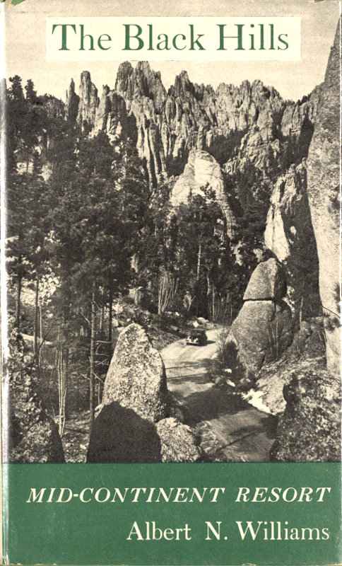
The Black Hills
MID-CONTINENT RESORT
BY Albert N. Williams
AMERICAN RESORT SERIES NO. 4
Southern Methodist University Press
1952
COPYRIGHT, 1952, BY
SOUTHERN METHODIST UNIVERSITY PRESS
PRINTED IN THE UNITED STATES OF AMERICA
BY AMERICAN BOOK—STRATFORD PRESS, INC., NEW YORK
AMERICAN RESORT SERIES
- No. 1: Gatlinburg: Gateway to the Great Smokies, by Edwin J. Foscue
- No. 2: Taxco: Mexico’s Silver City, by Edwin J. Foscue
- No. 3: Estes Park: Resort in the Rockies, by Edwin J. Foscue and Louis O. Quam
- No. 4: The Black Hills: Mid-Continent Resort, by Albert N. Williams
For Chris
Acknowledgments
The research on early Black Hills and Badlands history was ably assisted by Miss June Carothers, whose services were provided the author through a generous grant-in-aid by the University of Denver’s Bureau of Humanities and Social Development.
Miss Ina T. Aulls, Mrs. Alys Freeze, Mrs. Opal Harber, Miss Margery Bedinger, Mrs. Margaret Simonds, Mrs. Elizabeth Kingston, and Mrs. Clara Cutright, all of the Denver Public Library, are particularly to be thanked for placing the resources of that institution at my disposal.
For assistance in preparing the manuscript, I wish to thank Miss Helen Kiamos, Miss Edith Goldfarb, and Miss Lillian Helling.
I am indebted to Bell Photo of Rapid City for the photograph of the Needles highway; to Ned Perrigoue of Rapid City for that of Sylvan Lake; to the Denver Public Library Western Collection for those of Calamity Jane, Wild Bill Hickok, and Deadwood Gulch in 1881; and to Mr. A. H. Pankow of the South Dakota State Highway Commission for that of a Black Hills stream.
And finally, as always, thanks go to my wife, Ann, for her patient editorial help.
Albert N. Williams
University of Denver
Denver, Colorado
Books by Albert N. Williams
LISTENING
ROCKY MOUNTAIN COUNTRY
THE WATER AND THE POWER
THE BOOK BY MY SIDE
Contents
- I The Black Hills: The Forbidden Land 1
- II The Formation of the Black Hills 15
- III The Hills Today 27
- IV History I: Indians and Gold 47
- V History II: Deadwood Days 78
- VI The White River Badlands 115
- Bibliography 126
- Index 127
Illustrations
- Along the Needles Highway facing page 34
- Harney Peak—older by ages than the Rockies 35
- The Four Great Faces: Mount Rushmore Memorial 50
- Sylvan Lake mirrors great granite shields at an elevation of 6,250 feet 51
- Calamity Jane, during her carnival days 82
- Wild Bill Hickok, from an early portrait 82
- Cheyenne—Black Hills Stage carrying bullion guarded by shotgun messengers 82
- Deadwood Gulch in 1881 83
- Modern Deadwood—seventy years later 83
- One of the Black Hills’ many streams 98
- The Badlands: Desolate, empty, and seared 99
Introduction
I have had an opportunity to enjoy one of the most readable accounts of the Black Hills I have ever come across. It is written to acquaint traveling America with an area which was long off the beaten path of tourists, and which has only during the past quarter century been recognized as a place where people who wish to “Know America First” may profitably spend some time.
Mr. Williams has outlined the historical reason why this small wonderland was so long outside the consciousness of America, and he has devoted a chapter to telling about the methods of nature in producing the intricacies of this formation, older by far than the Alps or the Himalayas. He has made the subject live, and he includes enough expert terminology to satisfy the reader that he knows whereof he speaks.
In his chapter on “The Hills Today” Mr. Williams outlines what the tourist should see, and how to see it. For that chapter alone his book would be well worth the attention of every prospective sight-seer. He has two chapters pertaining to the history of the region, the first speculating on how the whole economic growth of the West might well have been altered had a confirmed story of “gold in the Black Hills” been released fifty years before it was spread-eagled on the pages of the Chicago Inter-Ocean. It is an interesting speculation, and he gives it a pleasing reality.
Another chapter deals with the lives of some of the characters exploited and given semi-permanent fame by the old dime novels. Deadwood without these characters would be just another picturesque town set down in a mountain valley; with them it becomes one of America’s better-known hot spots, vying with the Klondike and Leadville.
Mr. Williams’ last chapter on the Badlands, a neighboring phenomenon, a place of amazing mystery and strange disorder, serves to depict what might be termed the undepictable in terms exactly calculated to excite the reader’s absorbed interest.
Will G. Robinson
South Dakota State Historical Society
Pierre, South Dakota
December 17, 1951
CHAPTER ONE
The Black Hills:
The Forbidden Land
The thing to remember is that the Black Hills are not hills at all. They are mountains, the highest mountains east of the Rockies, with Harney Peak rising to a height of 7,242 feet above sea level. Inasmuch as the prairie floor averages, at the four entrances to the Hills, only 3,200 feet in elevation, these are mountains of considerable stature.
The title “hills” was by no means given the area by early white settlers. Indeed, if that majestic domain had not already been named the Black Hills by the Indians, George Armstrong Custer, who in 1874 made the first full-scale exploration of the region, would no doubt have dignified it with a more appropriate and properly descriptive name—the Sioux or the Dakota Mountains, in all probability.
From time beyond remembrance, however, the region had been known to the Indians as Paha Sapa, exactly to be translated as “Black Hills,” and very properly that name was accepted by government geographers. The use of the word “black” possibly fulfilled several functions, for not only do these massive peaks appear decidedly black when seen against the horizon across distances as great as a hundred miles, but they were, to the superstitious braves of the Teton Sioux, the abode of the Thunders and studiously to be avoided.
This taboo fastness was one of the last regions in the great American West to be explored and settled. For one reason, it enjoyed an isolation from the centers of development that served to discourage any but the most hardy of explorers. Lying in the extreme western end of present-day South Dakota, the Black Hills were two hundred miles west of the settlements around Pierre, on the Missouri River, and two hundred miles north of the towns along the North Platte, the valley of the Oregon-California Trail. The most important reason, though, for its belated opening was that gold was not discovered in the Black Hills until 1874, and it was the discovery of gold in various sections which more than any other single set of circumstances dictated the pattern of the development of the trans-Mississippi West.
Even today this fascinating region remains nearly the most remote of all America’s resort and recreation areas. The Grand Canyon lies but an hour’s drive from a major east-west transcontinental highway. Estes Park,[1] in the Rockies, is only seventy miles from the city of Denver. Glacier Park is easily served by the Great Northern Railroad on its overland run, and Yellowstone enjoys direct service by three railroads. But the Black Hills lie beyond the privileges of railroad stopovers, and in order to visit them the tourist has no choice but to plan a vacation trip for the sake of the Hills themselves and not as a side venture from any of the traditional tours of the West. The Hills are worth the effort.
The Black Hills occupy a rectangular realm which is roughly one hundred miles long, north to south, and fifty miles across its east-west axis. The White River Badlands, which are customarily visited on any Black Hills trip, form a depression in the high prairies some forty miles long and fifteen miles across the widest part. This stark and empty waste is to be found some seventy-five miles east of the Black Hills, or, more precisely, east of Rapid on U.S. Highway 14-16.
There are five major access routes to the land of Paha Sapa. From the west, which is to say from Yellowstone Park, five hundred miles distant, the Hills can be reached by U.S. Highways 14 and 16. These routes come in together across the high plains of northern Wyoming, and separate a few hours’ drive from the South Dakota border, 14 veering to the north and 16 continuing through the central section of the Hills.
From the south, U.S. 85 comes up from Denver, four hundred miles distant, crossing the Lincoln Highway at Cheyenne, and continuing along the route of the old Cheyenne-Deadwood stage.
From Omaha and points in the southeast, the Hills are best reached over U.S. 20 across the top side of Nebraska. Although this route is not a major east-west route for interstate tourists, it serves a busy agricultural section and is generally in fine repair.
From the east U.S. 14 and 16, again, bring the tourist through Pierre, on the Missouri River, past the Badlands, and into the Hills through Rapid City. From Minneapolis the distance is just over six hundred miles, while from Chicago it is very nearly a thousand.
For those entering the region from the north, U.S. 12 from Miles City, Montana, is in all probability the best route.
The gateways to the Black Hills are the towns of Hot Springs in the south, Rapid City on the eastern edge, Spearfish or Belle Fourche at the north, and Custer in the west. All these towns offer entirely acceptable accommodations for a touring family; in fact, no one need drive more than twenty or thirty miles from any point in the area to find suitable lodgings at a desired rate.
Hot Springs, on U.S. 18-85A and State 87, is situated at an altitude of 3,443 feet and has a population of approximately five thousand. It is the one sector of the Black Hills that does not owe its original development to the gold rush of the seventies, but was sought out from the earliest days for its natural thermal springs.
The town is located in a large bowl of the southern hills known as the Vale of Minnekahta, from the Sioux name for “warm waters.” Situated as it is on the rim of the Hills region, it was not included in the general taboo that cloaked the rest of Paha Sapa to the north; and for nearly a century before its discovery by the white man in 1875, it was a favored health resort of the Indians. As a matter of fact, Battle Mountain, which overlooks the town, takes its name from a legendary war between the Sioux and the Cheyenne for the exclusive privileges of the hot baths.
Not long after the discovery of the springs a syndicate of investors who had come into the Hills from Iowa bought the ranch claims that had been taken out in the Minnekahta Canyon, and sought to develop the region as a spa. This was in the late eighties when salubrious waters were in high fashion as a cure for arthritis and other joint and muscular disorders of various degrees of complexity. Colonel Fred T. Evans, who had made a fortune operating a bull-team freight line from Fort Pierre to Rapid City, built an elaborate resort, the Evans Hotel, which even today is imposing in its last-century splendor; and with the arrival in 1890 and 1891 of two railroads, the Chicago and Northwestern and the Burlington, wealthy cure-seekers from all over the United States made it their habit to spend the summer months in this pleasant town.
Highways leading into the Black Hills.
Healing waters have long since gone out of vogue as a form of recreation, and although several clinics still treat a modest number of visitors for one indisposition or another, the town of Hot Springs has ceased to be a tourist center of any consequence. Also, the fact that the Springs are located a considerable distance south of U.S. 16, the main east-west route through the Hills, has contributed to the increasing isolation which this town enjoys, drowsily seeing to the wants of the occasional visitor who strays into Paha Sapa from the south along U.S. 85. But do not mistake it, it is a pleasant town to stop in, with excellent motor courts and a good selection of restaurants.
The town of Custer, a scant fifteen miles from the Wyoming border on U.S. 16, is little more today than a tourist stopover. It is almost two thousand feet higher than Hot Springs, at an altitude of 5,301 feet, and contains, according to the latest estimates, nearly two thousand residents.
As the tourist enters the town he will immediately be amazed by the wide main street; but if he ponders for a moment the problems of turning a freight wagon behind sixteen oxen, the reason will become clear. Custer, the western gateway to the Hills, was, until the coming of the railroads, a major way station on the busy Cheyenne-Deadwood stage and freight route; and for fifteen years the great bull wagons teamed into this busy center where, in most cases, the goods were unloaded and trans-shipped by lighter wagons into the various mining centers throughout the northern and central Hills.
Custer, the oldest of the white man’s settlements in Paha Sapa, was founded in 1875 by gold-seekers who flocked into the territory following the reports of yellow metal sent back by George Custer after his exploratory campaign of 1874. In the first spring and summer of its existence more than five thousand miners swarmed into the region to pan gold. This invasion was a violation of the government’s treaty with the Sioux, and the military forced the argonauts to leave.
By 1876 the Indian problem had come to a head with the defeat of General Custer on the Little Big Horn in eastern Montana; and as one phase of retaliation the federal government redrafted the Sioux treaty, allowing American citizens to enter the Black Hills, until this time reserved for the Indians. Although for some time the tribal leaders could not be persuaded to sign the revised agreement, the restrictions on settlers were removed, and back into the Hills rushed the prospectors—this time to the new strikes in Deadwood Gulch, in the north.
By the middle of 1877 Custer, where gold had originally been found, had a population of a mere three hundred souls, all of them concerned primarily with the operation of the stage stations and hostels. True, a few grizzled placer miners still worked the streams near by, and do to this day; but hard rock mining in Deadwood was the new order of affairs.
The visitor to this section of the Hills today will find it pleasant to stay the night in any one of a wide choice of tourist courts and other reasonable billets, and he may see much of historical interest within a few miles’ drive of Custer. A settler’s stockade, reconstructed to the original model of 1874, is a remarkable site to visit, and the Jewel Cave is best reached from this point. For sheer color and pageantry the annual celebration of Gold Discovery Days, which is held at Custer late in July—near the date of the discovery of gold, July 27—is an affair not to be missed during a Black Hills vacation at that time of year.
The town of Spearfish is the point of entrance to the region on U.S. 14, or, coming in from the north, on U.S. 85. This tidy metropolis, called the Queen City of the Black Hills, never knew the heady history that marked the early days of Custer, of Deadwood, of Rapid City, or even of fashionable Hot Springs. Lying outside the magnificent natural bowl of mineral deposits, Spearfish was founded and exists today for the simple purpose of supplying the inner Hills with food and produce. It has a population of between three and four thousand people, most of whose energies are devoted to agriculture and livestock.
Spearfish has, however, carved for itself a fame and renown even larger, in many quarters, than that enjoyed by the gold rush towns of gustier memories. It is the home of the Black Hills Passion Play.
This beautiful and stirring performance, which is given in a large amphitheater on Tuesday, Thursday, and Sunday evenings throughout the summers, is a resurrection in an American atmosphere of the centuries-old Passion of Luenen, in Germany. The man who plays the Christus, an inherited responsibility through many generations, is Josef Meier, who fled from Europe in 1932. For six years, with a reassembled cast, he toured the United States, performing a much trimmed-down version of the historic morality on college campuses, in civic auditoriums, and at summer encampments. It was at such a performance at the Black Hills Teachers College that the citizens of Spearfish were inspired to offer the touring company a permanent home. Meier and his group eagerly accepted the offer, and the town constructed an outdoor theater seating eight thousand people. Now, each winter the Passion Play continues its tour of the United States, but all during July and August it remains in residence, acting its moving and majestic pageant to constantly packed houses.
The eastern gateway to the Hills is Rapid City, a metropolis of thirty thousand people which lies on the level prairie just to the east of the final ring of foothills. Founded, like Spearfish, not as a mining center but to serve the near-by gold regions, Rapid City has developed a maze of industrial and commercial enterprises. Shipping, of course, has been a basic form of commerce from the earliest days, with the two most heavily traveled trails into the Black Hills, that from Fort Pierre and that from Sidney, Nebraska, on the Union Pacific, entering the gold area at Rapid City. Lumbering, manufacture, banking, and livestock quickly became prominent as the gold fever subsided and the more permanent settlers began coming into the region to take up the rich cattle and farming lands in western South Dakota. A final guarantee that Rapid City will continue to flourish may be seen in the selection by the Air Force of the high, level prairie land just ten miles to the east of the city as the nation’s major mid-continent bomber base.
Rapid City is served by U.S. Highway 14-16, and South Dakota state highways 40 and 79. Two railroads and a major airline assist in handling the heavy summer tourist travel, and from Rapid City practically every point of interest in the Black Hills can be reached by car within three hours.
CHAPTER TWO
The Formation of the Black Hills
One of the most rewarding features of a visit to the Black Hills is the opportunity for the average individual, who has no technical training, to see with his own eyes a museum of the earth’s ages and a living sample of practically every one of the many aeons of the planet’s history.
The Hills, which is to say the rock substances of the region, are older by hundreds of millions of years than the stone out-juttings of the Rocky Mountains. Layer after layer of slates and schists from the very foundations of this globe lie visibly exposed as the end result of a doming of the region, a vast blistering, as it were, which raised the entire structure, layer upon layer, several thousand feet in the air. Following this doming process, a vigorous program of erosion commenced. Stratum by stratum the winds and rains cut across this huge blister in a horizontal plane, eventually laying the core open at the height above sea level at which we find the Black Hills today. From that core, extending in every direction in the general form of a circle, the various strata which once lay so smoothly one upon another have been laid open as one might slice off the top of an orange.
The Doming of the Black Hills
Rock Strata being shifted into a dome at the time of the great continental uplift.
The forces of erosion—wind and water—have levelled the dome and opened the seams to view.
In order to get an even clearer picture of how this amazing phenomenon came about through the aeons, let us fold back the ages to the very birth of this planet.
For centuries men have attempted to determine the earth’s exact age, but except for the famed Archbishop James Ussher of Ireland, who gravely calculated that the earth was formed at precisely nine o’clock on the morning of the twelfth of October in the year 4004 B.C., no scientist has been able to come closer than a few million years in the figures. Through a number of trustworthy measurements, however—including, in recent years, the examination of the deterioration of radioactive elements in rocks—geologists have agreed that the oldest known ingredients of the earth’s crust have been in existence at least two billion years, and, according to some very recent calculations, possibly as long as three and a half billion.
In what is known as the Archean period, the most ancient of which we have any geological knowledge, a vast sea covered much of North America, bounded by certain masses of land, the extent of which has never been discovered. From this land mass remnants of mud and sand were broken away by waves and deposited on the floor of the sea. Eventually, under the pressure of its own weight, this material formed shales and sandstones to an undetermined depth—many thousands of feet. Those particular sandstones and shales underlie the entire Black Hills area and extend in nearly every direction for a considerable distance, suggesting perhaps that the area of the Hills was at one time the bottom of this watery bowl.
The Archean period came to an end some five hundred million years ago. By then the seas had withdrawn, and the new land formations which had lain under the early ocean merged with the vestiges of the first land mass. But this metamorphosis, which can be described in such calm fashion, was by no means a gentle affair. It took place largely as the result of a shifting and rising of certain ocean bottom areas, among which was the region where we now find the Black Hills.
At the time of this uplift, and possibly contributing to it, there was a tremendous disturbance in the lower regions of the earth which sent great streams of molten matter up into the several-mile-thick layer of shale, through which it poured toward the surface, breaking through in monolithic forms and hardening into granite. The New Mexico writer, Eugene Manlove Rhodes, describing a similar geologic phenomenon in the valley of the Rio Grande, has called it “like sticking a knife through a tambourine,” and indeed it was. Harney Peak, in Custer State Park, is just such a granite finger pointing up through the original shales toward the sky.
When this disturbance took place the granite juttings did not rise above the surrounding landscape as they now do. In many cases they did not even reach the surface of the shale beds, but ceased their flow and hardened short of the crust of the earth, as it was then to be found. When, however, the region was domed, many millions of years later, the subsequent weathering of the huge blister did not attack these granite formations with anywhere near the vigor with which the softer sandstones and limestones were eroded. What actually occurred, then, was a peeling away of the softer rocks, leaving the granite formations near their original sizes, but at last above the ground level in the form of peaks, needles, and spires.
But we have gotten ahead of our story. Following the Algonkian period, when the molten matter was injected into the layers of shale, there came what is known as the Cambrian period. The Cambrian occupied the first 80,000,000 years of the Paleozoic era, which in itself covered the entire period from 510,000,000 to 180,000,000 years ago.
During the Cambrian period the land subsided again, perhaps because of the weight of the uplifted sedimentary formations. During this subsidence the waters once again covered vast portions of North America, and additional muds and slimes were deposited on the bottom. It was at this period that life first appeared on the earth, in the form of simple marine organisms which have left fossil remains. These deposits made in the Cambrian period can be seen in outcroppings all through the region, although they are most notably found in the area about Deadwood. Because of their structure they indicate to the geologist that the shoreline of the ancient Cambrian sea was near at hand, and also that this covering of water was by no means as extensive or as deep as the earlier Archean sea.
The deposits of sand and mud, which were eventually pressed into stone, occasionally reach a depth of as much as five hundred feet, although they were laid down extremely slowly, as eddying mud is laid at the bottom of a pond. In the locality of Deadwood they contained a rich infiltration of gold, and the entire conglomeration was thoroughly intermixed with a vast outcropping of much older rock—this effect undoubtedly having taken place later, during the great continental uplift, when the final doming occurred.
THE AGES OF EARTH
| MILLIONS OF YEARS AGO | (Pre-Cambrian Existence back to 3½ Billions of years) |
|---|---|
| PALEOZOIC ERA | |
| 510 | |
| Cambrian Period—First fossils deposited. Marine life. | |
| 430> | |
| Ordovician Period—Invertebrates increase greatly. | |
| 350> | |
| Silurian Period—Coral reefs formed. First evidence of land life. | |
| 310> | |
| Devonian Period—First forests. First amphibians. | |
| 250> | |
| Mississippian, Pennsylvanian, and Permian Periods.—Reptiles and insects appear. Continental uplift at end of this period. | |
| 180 | |
| MESOZOIC ERA | |
| Triassic Period—Small Dinosaurs. First mammals. | |
| 150> | |
| Jurassic Period—Dinosaurs and marine reptiles dominant. | |
| 125> | |
| Cretaceous Period—Dinosaurs reach zenith of development then disappear. Small mammals. Flowering plants and development of hardwood forests. | |
| 60 | |
| CENOZOIC ERA & PERIOD | |
| Paleocene Epoch—Archaic mammals. | |
| 50> | |
| Eocene Epoch—Modern mammals appear. | |
| 35> | |
| Oligocene Epoch—Great apes appear. | |
| 25> | |
| Miocene Epoch—Grazing types of mammals appear. | |
| 10> | |
| Pliocene Epoch—Man appears. | |
| 0 | |
The next period of the earth’s age—the Ordovician period, which extended from 430,000,000 to 350,000,000 years ago—has left its mark just as visibly upon the Black Hills. It was during this period that the many species of invertebrate marine life reached a zenith of development, and that a bed of sediment was laid down and later compressed to a pinkish limestone. The fact that this Ordovician bed is less than forty feet thick indicates that the land mass from which the muds and sands were drawn was very low, and that the Cambrian sea was relatively shallow, entertaining only minor erosive currents along its shores.
The next two ages, the Silurian and the Devonian, which brought our earth down to a scant 250,000,000 years ago, did not see the deposit of any silting in the Black Hills region. No doubt the waters which covered the locality dried up gradually. The Mississippian period, however, was a time of great depositional activity. A layer of limestone between five and six hundred feet thick was set down over the entire section. In later periods this limestone underwent much decay and water erosion, which formed the amazing caverns for which the Black Hills are known. Wind Cave, now the site of a National Park, Crystal Cave, and Jewel Cave are the best-known tourist attractions among the many, although there are a number of lesser ones, some even today only partially explored.
The chemical activity which accomplished this erosion was caused by the seeping of rain water down through later accumulations of sediment on top of the layer of limestone. As it seeped through rotting vegetation and timber the water collected carbonic acid gases which, when it reached the level of the Mississippian limestone, eroded the structure and ate out huge hollows in it.
The thickness of the Mississippian deposit indicated that at this time the earth had again sunk beneath the waters to a considerable depth. The shallow sea which had not offered sediment to a greater depth than a few feet was replaced by active currents which carried heavier sedimentary materials from great distances, laying them down on the floor of the sea in various strata to a depth of several hundred feet. Finally, after an unknown number of millions of years, but perhaps during the Triassic period, the land again rose above the level of the waters. A red shale suggests a time of great aridity when the region must have been a near desert, and certain discernible patterns in the shales suggest periods of rapid evaporation and a consequent change in chemical activity.
Finally the land subsided again, for the last time to date. At times salt water covered the region, and at other times fresh water left its chemical mark. At some levels in this last layer of sedimentary rocks an abundance of fossils can be found, indicating deep water, and at others ripple-marked rock indicates very shallow water. It remains a period of great mystery. How long this final submersion continued we do not know; but in all probability it lasted nearly a hundred million years, and then was terminated by the vast upending of North America which created the Rocky Mountains. This upheaval did not take place suddenly, as a volcanic eruption or a series of earthquakes, but apparently commenced about sixty million years ago and lasted, as a continuous series of shiftings and slow upheavals, for about twenty million years.
At the beginning of this mighty uplifting the region of the Black Hills was covered by the various layers of sedimentary deposits to a depth of nearly two miles. Slowly this rectangular area was lifted as a dome over the surrounding prairies. We do not know how high above the level lands this dome reached, but we do know that several thousand feet of later deposits overcapped the granite upthrusts which were planted in the fundamental shales. Those granite fingers, which have now been exposed to view, stand from five hundred to four thousand feet above the plains, and thus the original dome may be assumed to have extended from eight to ten thousand feet above our present-day sea level.
Almost as soon as this era of upheaval first started, as soon as the first land of the Black Hills was elevated above the great sea, the forces of erosion set to work. Wind and rain worked their terrifying magic on the slowly rising terrain, carving away the softer rocks and the loose dirt and leaving only the granite outcroppings. Down from the sides of the great dome poured the waters of melting snows, gushing springs, and torrential rainfalls, digging out rivers, canyons, and the deep and narrow cuts which characterize this beautiful region. Slowly the land continued to rise and the oceans to fall until at last an equilibrium was reached, a static state of affairs which remained much the same until our own period, when the base of the dome was at last revealed, with the surrounding lands drifting away in every direction on a gentle incline.
From that day the structure of the Black Hills has changed but little. The high winds off the Dakota plains and the annual spring run-off and seasonal rains cut their minute etchings in the landscape; but Nature’s greatest effort in the Black Hills part of the world has, it seems, been made. It must be remembered, though, that Nature has had other responsibilities. At the time of the doming of the Black Hills the Alps had not yet been formed, nor the Pyrenees, nor the Caucasus. And on the site of the mountains we know today as the sky-piercing Himalayas, the swampy waters still moldered.
CHAPTER THREE
The Hills Today
It is this writer’s personal opinion that no other resort area in the United States possesses such a wealth of tourist attractions as the Black Hills. This profusion of happy endowments can be separated into three categories, each of which deserves individual study and enjoyment. Two of these, the region’s folklore and its memories of the gold rush, belong to the amazing history of the Hills. But of course the visible landscape and the natural wonders of the area are the primary objects of the tourist’s visits, and it is proper that they be considered immediately and in detail.
Wind Cave
The Wind Cave lies ten miles north of Hot Springs on U.S. 85A. The cavern is the focal point of interest in its own National Park, which takes in forty square miles. Nearly half of this park is enclosed with a high fence, behind which one of the last great bison herds roams contentedly. Protected antelope, elk, and deer also enjoy this game preserve.
The cavern was discovered, according to legend, by a cowboy who heard a continued low whistling noise in the weeds and, investigating, found air rushing from a ten-inch hole near the present entrance to the cave. And indeed it is this very phenomenon that makes Wind Cave different from other notable caverns, such as the one at Carlsbad. Even on the stillest of days a steady current of air can be felt rushing in or out of the cave’s opening—into the earth if the barometer is rising, and out of the ground if the pressure is falling.
The National Park Service conducts tours of the cave, the complete excursion lasting some two hours. Fortunately, although the visitor descends to a great depth as he searches out the various chambers on the route, the tour ends at an elevator which whisks him swiftly to the surface near the starting point.
The entire cavern is a little more than ten miles long, although there are portions of it which have not even yet been explored so that their size may be known with accuracy. It is not graced with the growths of stalactites and stalagmites normally to be found in limestone formations, but nature has compensated for that lack by fashioning a peculiar box-work which looks for all the world as if the cavern had been subjected to an interminable frosting process. These beautiful fretwork deposits, which are not to be found in any other cave, are the result of a strange chemical process that took place in the limestone stratum where Wind Cave is located. Surface water seeping into the stone became charged with carbon dioxide gas from the decaying organic matter through which it passed. This gentle acid then dissolved the limestone only to redeposit it in cracks and crevices around other limestone fragments. The precipitated limestone was of a different chemical composition and resisted later onslaughts by the eroding acids—which, however, did eat away the fragments around which the precipitate had formed, leaving the maze of hollow crystalline formations that can be seen in the various chambers of the cavern.
The National Park, being relatively small, is not equipped with overnight facilities; but this does not matter, for the town of Hot Springs is but twenty minutes’ drive from the park, and the town of Custer is only twenty miles away. There are, however, camping grounds in the park, and the Park Service operates a lunchroom at the entrance to the cave.
Custer State Park
Custer State Park is located almost in the center of the Black Hills. Containing nearly one hundred and fifty thousand acres, it is one of the largest state parks in America. It was originally set aside as a state game refuge, and it was not until the advent of summer touring as a national pastime that the state of South Dakota purchased additional private lands which contained scenic wonders, incorporating all of them into the one large area.
Today the park is the center of all tourist activity in the region. A number of excellent lodges, camp grounds, and tourist courts along every road make it particularly easy for the tourist to stop at will for a day or more to enjoy the various recreational facilities as his fancy dictates. In every respect the park is effectively administered: food and lodging prices are held to a reasonable figure, the cleanliness of the buildings and grounds is regularly inspected, and the landscape is protected from commercial exploitation.
The center of the park’s activities is the Game Lodge, a monstrous Victorian hotel built in 1919 and operated under a private lease. Close by the Game Lodge are cabins, stores, eating establishments, the park zoo, a museum, and the offices of the state park officials. The Lodge, those with a flair for nostalgia will recall, achieved international renown in 1927 when President Coolidge made it the summer White House. It lies on US. 16, thirty-two miles from Rapid City and seventeen miles from the town of Custer.
It behooves the writer to mention at this point that the museum connected with the Game Lodge is by no means the drab and dusty sort of collection of impedimenta associated with the vicinity that is so often found in museums at scenic sites. Indeed, this fine attraction is an assemblage of geological, paleontological, and historical items which trace with rare discernment the whole history of the Hills through the ages, and up to our own day. The visitor who fails to pass an hour in this exciting spot will have missed the heart of the Hills entirely.