Lisnacroghera crannog lies at a little distance from Broughshane, in the parish of Skerry, barony of Antrim. About the year 1882, workmen employed in cutting turf—bared by the partial drainage of the lough—came upon oaken timbers laid in regular order; unfortunately nearly all were removed before anyone acquainted with the peculiarities of crannog structure had seen them, and in the autumn of 1883, most of the timbers had disappeared, though a few of the encircling piles remained in position. Some remarkable antiquities, discovered either within or around it, have been rescued from oblivion and destruction. A spear with iron head and butt, and rivets of bronze, and the iron sword-blades enclosed in sheaths of bronze (which are now in Canon Grainger’s museum), seem to call for prominent notice. With regard to these the Rev. James Graves says:—“It cannot be denied that this crannog find is one of the most important and valuable yet recorded in Ireland, especially in its bearing on the style and the chronology of the art of that early period when the bronze and iron eras overlapped. The spears have bronze butts, with terminal iron heads, for such were discovered in the crannog, whilst no spear-heads of bronze—an imperishable metal—were found. The bronze rivets remained in the shafts by which the iron heads had been secured. All this reminded one of the ninth century legend of the armourers of the Tuatha dé Danann when preparing for battle with the Fomorians at the northern Moytura. The mode of workmanship is graphically described:—Goibniu at his forge finishes the spear-heads in three hammer-strokes (probably they went through three processes in their fabrication); so it was also with the work of Luchtiné on the ashen spear-shafts, and Creidné on the bronze rivets. When Goibniu had finished the iron lance-head, he seized it with his pincers and sent it quivering into the door-post. Then Luchtiné launched the finished shaft so surely aimed that it found the socket of the lance-head, and penetrating to the bottom was firmly fixed there: whilst Creidné instantly flung from his pincers the finished bronze rivet with so sure and true an aim that it entered the rivet-holes to the required depth, and so the weapon was completed (Three Irish Glossaries, p. 32, Sanas Cormaic, p. 123). Hence, without assuming that the bronze-iron age should be thrown back to the mythic period of the Tuatha dé Danann and the Fomorians, it is evident that in the ninth century there was a tradition of its characteristics and existence in Ireland, and that of so remote a date as to suit the myth of the contest of the gods of light and life with the deities of darkness and death. The fashion of the spears, of the swords, and of their sheaths, prevailing at this early period, when the use of bronze and iron overlapped, has been hitherto but sparingly revealed to us by finds of weapons in England, Scotland, and Scandinavia. Kemble, in his Horæ Ferales, engraves several examples of short swords or daggers, the fashion of which is identical with that now for the first time so clearly shown us by the Lisnacroghera crannog find.” Professor Anderson, in his Rhind Lectures, has recorded the discovery of a bronze spear-butt, exactly similar, in one of the brochs of Scotland; it is correlated by him with the pagan iron age; and in a recent number of the Proceedings of the Royal Society of Antiquaries of Denmark there is engraved an iron sword-blade, with bronze haft-mountings, nearly identical in form and fashion with those discovered at Lisnacroghera.[195]
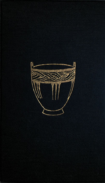
The antiquities found in this crannog consisted of a plain bronze sheath (plate XII., fig. 1), containing an iron sword (p. 61, fig. 17): the haft is represented full size (plate XXXIX.). One side of ornamented sheath slightly smaller than the former (plate 12, fig. 2): a full-sized representation is given (plate XL.).
Plate XL.
Upper and lower portions of side of the Bronze Sheath, from Lisnacroghera, full size, of which a half-size representation is given, Plate XII. fig. 2.
Another ornamented bronze sheath (plate XII., fig. 3), of which the upper portion is here given, full size. A sword of iron with bronze fittings to the handle: this is not the sword to which the sheath belongs. An iron sickle that had been affixed to its handle by a tang; their usual length was twelve inches—occasionally much smaller—and they may be divided into two classes, bronze and iron. Sickles of iron have been found amongst Roman and Saxon remains in Britain. A spear-head of iron (ante, plate X.). An iron adze (ante, p. 69, fig. 31), and some miscellaneous objects of the same metal (ante, p. 68, figs. 28 to 30). Six butt-ends of spear-shafts formed of bronze: five of these are represented (p. 64, figs. 19 to 23); the sixth is here given (fig. 201). Boss-like objects (six in number) and rings of bronze, supposed to be fragments of defensive armour (plate XV.). A bronze rivet (ante, p. 119, fig. 152). Two hollow penannular rings of bronze (ante, p. 119, fig. 150). An article composed of bronze, probably an amulet (ante, p. 116, fig. 145). An object in bronze, richly decorated (ante, p. 67, fig. 26). Three circlets of bronze (ante, p. 119, figs. 153-5). A small loop of bronze (ante, p. 109, fig. 135). A disc composed of thin bronze (ante, p. 72, fig. 34). A small boss or stud of bronze (ante, p. 119, fig. 151). Portion of an amulet of jet. Three beads of glass (ante, p. 124, figs. 165-7).
Craigywarren.—Ante, p. 110.
Loughavarra.—Ante, p. 153.
Lough Lynch.—Ante, p. 153.
Lough Crannagh (or Lough-na-crannagh).—Ante, p. 28.—Amongst the scientific grants for the year 1885, recommended by the Council, R.I.A., appears the following;—“£20 to Mr. Alexander M’Henry for a report on the animal and other remains found in the sand-hills of Ballintoy and the crannog of Lough-na-crannagh.”
Lough Ronel is a name set down in the MS. register of Irish crannog objects, &c., British Museum. It is most probably an incorrect designation for Lough Ravel.
COUNTY DOWN.
During the working of the Commission for the Arterial Drainage of Ireland, a crannog—no name given—was discovered in this county, and traces of another at Ardbrin (ante, pp. 126-8).
Ballykinler.—In 1860 this crannog was no longer traceable, but fortunately a short description of it had been previously given. The section made through its centre showed it to be of the usual construction—surrounded by a circle of small piles, driven deep into the mud, and secured by cross-beams firmly mortised together, the space so enclosed filled with brushwood, on which was placed a layer of gravel and earth, that process being repeated until the surface became perfectly solid.[196]
Lough Faughan, or Falcon, in the barony of Lecale.—About the year 1845 a crannog was discovered in this lake. “There were large stakes driven into the ground, completely enclosing the space within, and not rising above the surface as a palisade, but evidently for the purpose of keeping in the soil from encroachment of the water. The tradition respecting it is, that there had been a castle on the shore opposite, the chieftain of which caused this island to be made as a place of refuge from the sudden onslaughts of the O’Neils; and to render this retreat more secure he would never allow more than one boat or canoe on the lake.” During drainage operations a “dug-out” of oak was found near this crannog, from which locality were also procured two earthen pitchers (ante, p. 92, fig. 66).
Ballywoolen.—This crannog was entire when seen in 1860, in a lake surrounded by hills, the surface of the island nearly level with the water. At one spot there was a flagging of flat stones where the hearth had been, and near it lay a quern.[197] The discoverer states the site of this crannog to be in the county Down; but the only townland in Ireland named Ballywoolen, is set down in the Ordnance Survey as situated in the parish of Dunboe, barony of Coleraine, county Derry.
COUNTY ARMAGH.
Camlough has a crannog at its north end.
Marlacoo Lough, near Armagh, has another.
Lough Ross, near Crossmaglen, also contains one, stated to have been the place of meeting of the Irish leaders in 1641.[198]
COUNTY TYRONE.
During the working of the Commission for the Arterial Drainage of Ireland, a crannog was discovered in this county, but its exact locality was not defined.
Corcreevy (alias Loch-Laoghaire), by which latter name it is mentioned in the Annals (ante, pp. 155-6).—The site was examined and the following articles brought to light: a pair of bronze and iron manacles; a double comb of bone in a perfect state, length 3 inches, and breadth 2⅜ inches, and having a brass ring attached to one extremity—it is now in the Museum, R.I.A.; parts of a musical instrument; an arrow-head; a spear-head; a sling, or hammer-stone.[199]
Cranny townland in this county possibly derives its name from having been the former site of a lake dwelling.
Clogherny, in the parish of this name, in the barony of East Omagh. The Rev. R. V. Dixon, D.D., thus notices the discovery of a crannog situated in a bog on the borders of the townland of Roscavey. About eight or ten feet below the surface turf-cutters laid bare the tops of a row of oaken planks which described a circle about seventy feet in diameter. These planks were from eight inches to fourteen inches in width, and from three inches to five inches in thickness, roughly split from the log, the lower extremities pointed and driven ten or twelve inches into the ground; their tops were all decayed; the length of the remaining part was about four feet. Each plank was pierced by a square hole, bearing marks of having been made by a blunt tool, and this orifice was narrower at the centre than at the edges. The planks forming the enclosure were placed edge to edge, and several rough logs of alder and birch, from two inches to four inches in diameter, were laid horizontally against the lower part of the planks on the inside of the enclosure, which was floored with oak, and underneath was about two feet of peat. Between the oaken floor and the outer fence were several flag-stones, evidently the old hearths, as shown by the quantity of charred wood that was about them. Southward two square posts were found. This crannog lay in a depression running nearly E. and W. between two sloping hills. “The fall of this hollow is towards the east, where it spreads out and sinks into a large basin, or glen, closed by rising ground of considerable height to the north and east; by a gravel ridge, or ‘esker,’ on the south; and opening on the west into the hollow in which the crannog stood. A considerable mountain stream enters this basin from the east, and after flowing round a conical gravel hill (connected with the esker) which stands in the middle of it, escapes through a deep natural cut or gap in the esker which, as before mentioned, closes the basin on the south. If this cut were closed, the basin would be filled up by the stream which now flows through it, and the level of the water would probably rise sufficiently high to fill the hollow in which the crannog stood, and this hollow would then form a shallow arm of the lake.”[200]
Galbally.—Ante, p. 60, plate VII.
Roughan.—Ante, p. 88.
COUNTY DONEGAL.
Crannog-boy, parish of Inishkeel, barony of Banagh.—Ante, p. 28.
Mongavlin, parish of Taughboyne, barony of Raphoe.—Ante, p. 151.
Lough Veagh.—Ante, p. 154.
Drumkelin, or Drumkeelin, parish of Inver, barony of Banagh.—The account of the crannog-hut here exhumed is given, ante, pp. 39-41.
COUNTY DERRY.
Inishrush.—Ante, p. 152.
Loughshillen.—Ante, pp. 148-9.
Loughan Island.—Ante, pp. 153 and 155.—Six stone celts, two bronze celts, three fibulæ, a bridle-bit, two bronze cheek-pieces (ante, pp. 136-7), an iron spear-head and spike,[201] were found here, and are now in the Museum, R.I.A.
Fort Lough occupies nearly the centre of an extensive bog on the right-hand side of one of the roads leading from St. Johnstown to Burt on Lough Swilly. It is described as about one mile long, and a quarter wide, but was formerly of much greater extent. There was a tradition that formerly a castle erected in the centre of this lake had been submerged by the neglect of a girl in not carefully re-covering a fairy fountain in the vaults, and consequently the waters burst forth in a raging torrent! After drainage operations, when the level of the lough subsided, marks of an island became visible in the centre, and by degrees stonework was observed rising above the surface, proving that the subaquatic castle was not altogether mere visionary fiction. These walls were found supporting a deposit of peat.[202]
COUNTY FERMANAGH.
Plate XLI.
ELEVATION, PLAN, SECTION and DETAILS of the BALLYDOOLOUGH CRANNOG, Co. FERMANAGH.
W.F. Wakeman, 1870.
Ballydoolough (the place of the dark lake) is five miles distant from the town of Enniskillen; the expanse of water covers not more than twenty-four acres, and even during times of flood never exceeds twenty feet in depth; at the bottom could be discerned remains of a primæval forest. In June, 1870, from the effect either of drainage or of long-continued drought, a small island became apparent, on which were found fragments of fictile ware, and this led to a careful examination being made. Near the centre was an oaken beam, fifteen feet seven inches long, having evidently formed portion of one side of the lower framework of a dwelling. It was grooved throughout its entire length (plate XLI., No. 7), and had two holes—measuring nine inches by six—that were plainly intended for the reception of upright posts, to which the sheeting or side-boards of the structure were attached. Several oaken slabs, grooved at the sides (plate XLI., No. 9), were discovered in close proximity buried in the sand and mud. Upon clearing the foundation, the framework of the house was shown to be composed of well-squared beams of oak, grooved for the reception of planks, and mortised for the insertion of uprights, the angles dovetailed together, and fastened with wooden pins. The beam forming the eastern foundation of the house rested upon two blocks of dressed oak that projected from it at a right-angle to a distance of seven feet (plate XLI., No. 2), and this foundation may perhaps have supported a landing-stage. The lowest timbers of house and projecting beams were secured in position externally and internally by a row of wooden pegs, or small stakes, which enclosed the entire foundation, and rested against it on the exterior (on the plan these are indicated by a dotted line); the south-western angle of the house was strengthened by a flat block (No. 6). Of the upper work of the edifice no description can be attempted, though several dressed boards (Nos. 4, 5, 8, 9, 10, 13, on a scale of ⅛ inch to a foot), that had evidently formed part of the structure, were found scattered about.[203] On the western side of the island, being the one most exposed to the action of the water, the stakes were in greatest number, placed four, and at one point even five, feet deep. In some instances their upper extremities had been inserted in holes cut for their reception in beams of oak laid horizontally, and although only one such beam was found still in situ, yet an inhabitant of the locality stated that within his memory many of the horizontal timbers could be seen actually resting upon the stakes or piles, just below the surface of the water. The kitchen-midden of the dwelling contained a considerable quantity of bones, intermixed with numerous fragments of pottery. A selection of the bones having been forwarded to Professor Richard Owen for analysis, he pronounced them to be parts of Bos longifrons, Cervus elephas, Sus scrofa, and Equus asinus. In a more or less restored form, characteristic specimens of the pottery are figured (ante, pp. 92, 95, 96, 97). There were not many articles of bronze, but mention may be made of a plate of that metal, oblong in form, about as thick as a sixpenny-piece, and measuring five and a-half inches in length, by four and a-half inches in breadth; it retained a number of rivets, and appeared like a patch off some pan or dish. In Ireland the majority of cauldrons or dishes composed of thin golden bronze are usually found to have been carefully mended. Of wood, a vessel was discovered in an entire state, but from long saturation reduced almost to a pulp (ante, p. 102, fig. 103); and there was a small oaken vessel formed with staves. There were also balls of stone, varying in size from that of an orange to a walnut; several querns, and the inscribed stone described and figured (ante, p. 134).[204]
Coolyermer is the name of a lake four miles from Enniskillen, in the direction of Letterbreen; it contains an island which seemed to be composed entirely of oaken beams; the water, however, was too high to admit of an examination being made.
Drumdarragh, otherwise Trillick, has been recently thoroughly examined by W. F. Wakeman, whose report, accompanied by numerous drawings of remains discovered within the crannog, is prepared for publication in the Journal of the Royal Hist. and Arch. Association of Ireland. To the Museum of that Society the Earl of Enniskillen, in 1875, presented an oak paddle found at Drumdarragh crannog, in company with a single-tree canoe that had been unfortunately destroyed.[205]
Drumgay (the ridge of the geese) lies nearly four miles to the north of the town of Enniskillen, and separated from the northern shore of Lough Erne by a narrow belt of land. This sheet of water is completely land-locked; there are in it three islets, and the south-eastern shore has a projecting point of artificial construction that becomes an island owing to the rise of water in winter time. Plate XLII., No. 1, conveys an excellent idea of the general aspect of the lake, and of the position of the islands; the large wooded one, situated near the centre, and now known as “Bone Island”—although its older appellation appears to have been “Cherry Island”—is constructed of beams of oak, ash, and pine, laid in rough blocks, radiating from a centre to the edge of a circle formed of stakes set in the ground, the diameter from north to south being one hundred and five feet, but from east to west a few feet less (plate XLII., No. 2). When the lake is at summer level the encircling piles are plainly visible; they had been roughly trimmed with an instrument of metal; the longitudinal cuts measured nearly a foot, and some of the piles were of oak (plate XLII., No. 7); they had no slope outward, and only at a few points did the rough wood and small branches usually interwoven with them still remain in position. From a point near the centre of the crannog, in a direct line to the eastern shore, a trench was dug; it commenced in the centre, was cut outwards to the water’s edge, and thus prevented sudden flooding; a similar trench was subsequently made on the opposite shore. As the result of these excavations, a very distinct idea of the internal construction of the work was obtained (plate XLII., No. 4). The old crannog-builders appear to have selected a natural shoal in the lough as the scene of their operations. This shoal consisted of marl covered by a streak of whitish sand about four inches in depth; over the sand, to a height of six or eight inches, was a stratum of yellowish clay, which supported unhewn logs of oak and birch, together with an immense quantity of small branches, twigs, brambles, and small pebbles, all compressed into a peat-like mass about two feet thick; this was covered by two feet of earth, containing here and there layers of burnt clay and bones; the clay was mixed throughout with bones of animals greatly broken, articles of early manufacture, slag or dross iron, charcoal, and rough stones. The surface of the island was in many parts covered with flat stones of considerable size, and stakes larger than those which formed the outer circle, yet of the same character, were found here and there, even in the highest and most central parts; they were designed to stay and prop the work, for their points were deeply imbedded in the marl which formed the bottom of the lough. It was impossible to procure any perfect specimen of these supports, as the wood, softened by saturation, broke off on application of the slightest pressure. Scattered amongst the bones that lay upon the shore of the island, were several fragments of earthen vessels; the one represented (ante, p. 93) was found here. Although search was made, yet comparatively few antiques were brought to light.[206]
In plate XLII. a large island is represented to the extreme left; this is what may be termed a composite crannog. The body of the island, formed entirely of stones, was formerly surrounded by rows of oaken stakes; none, however, are now to be seen; they served as fuel to a man who lived on the shores of the lake. The greatest height of this island above summer level of the water was about five feet, the form an irregular oval, two hundred and seventy feet in length, by one hundred and thirty-eight feet in breadth, and a trench cut through to a depth of five feet reached what seemed to have been the ancient bottom of the lake. The great peculiarity of this structure is that the collection of small flat sandstones of which it was composed had been placed on edge (plate XLII., No. 5). By the country people it is appropriately styled “the quarry.” Close to the north-western extremity of the lake may be seen a small crannog—about thirty feet in diameter—that is all but submerged even in the dryest season; the few oaken timbers that remain seem to radiate from a common centre, and are intermixed with stones, as shown in plate XLII., No. 3. Evidently this islet had originally been strongly staked. The fourth and last crannog is represented at the extreme right of the general view of the lake; but here the crannog wrecker had been at work, and the stakes that formerly entirely surrounded it were pulled up and used as fuel. A curiously sculptured stone (ante, p. 90) was discovered here. The last two crannogs lay at a very low level, owing perhaps to the fact of an unusual quantity of boughs and compressible matter having been used in their construction. Portion of a single-tree canoe of oak was found in the lake, as also two very neatly formed paddles of oak, measuring about two and a-half feet in length.[207]
Gortalough (the field of the lake) is situated near Drumgay, and within three miles of Enniskillen. Here a log-house, or crannog-hut was discovered buried under many feet of peat, but no trace of it now remains.[208]
Drumskimly, near Derrygonnelly.—In this lake, now almost drained, there were formerly two crannogs that are in the present day dry and under cultivation; but there remained a little island surrounded by water and well palisaded in the usual manner; it was circular in form, and about thirty-five feet in diameter; its surface has been converted into a garden. From time to time were here disinterred a spear-head and arrow-head, both of iron; a pair of quern-stones, and many fragments of pottery; one of the latter is figured (ante, p. 100).[209]
Drumsloe.—See ante, pp. 87-88.
Ballaghmore is the name now applied to a lake (about a mile and a-half from Enniskillen) in which was a crannog seemingly composed entirely of earth and stones, in a soft depth of mud, surrounded with a mass of aqueous vegetation. No piles were visible.
Moinenoe (the bog of the yew) is a locality about a mile from Enniskillen, and sometimes called Chanter Hill. It was the former site of a lake which now in summer becomes a soft and treacherous swamp, and such traces of the crannog as yet remain would be difficult to explore. A single-tree canoe was found in the bed of the ancient lough.
Breagho (wolf-field).—Near a place of this name labourers when cutting turf came upon a stockaded enclosure buried some twelve or fourteen feet below the then surface of the bog; the crannog was circular, and about thirty-five feet in diameter. A pair of quern-stones, a large oaken, bowl-shaped vessel, split in several places, and the sawn and perforated bones of a Megaceros hibernicus, were the only “finds” recorded.
Aughlish.—In a lake so called, about five miles from Enniskillen, in the direction of Boho, there is a crannog, but the height of the water precluded an examination. The tops of numerous piles are frequently visible in summer-time.
Killynure (the wood of the yews) is a small lakelet, distant a mile from Enniskillen, on the Tempo road. It contains a crannog which is usually flooded.
Lough Acrussel is situated near Enniskillen. The crannog was found standing in deep water; but after a continuance of dry weather the piling all around could be distinctly seen, and the posts were, as a rule, connected by horizontal beams. Near the centre of the island there was a large flag-stone that had evidently been used as a hearth. Upon sinking shallow trenches through portions of the work, bones and teeth of animals of the usual character were discovered, as also iron slag, wood charcoal in small quantities, and some thin pieces of bronze, seemingly parts of a cauldron or dish. The plan of the crannog was nearly a perfect circle, and its diameter sixty feet.[210]
Lough Yoan.—In the summer of 1883, the crannog in this lake was visited by W. F. Wakeman, who reported that its surface seemed covered with bones of various animals, the larger of them having been broken apparently for extraction of the marrow. There were several whetstones and fragments of querns; but no traces of woodwork remained visible, though possibly by digging through the sand and stones, of which the shoal is chiefly composed, some discoveries might be made.
Lankhill.—In this lake, situated near Enniskillen, a crannog was discovered by W. F. Wakeman, by whom it will be described in a forthcoming number of the Journal Royal Hist. and Arch. Association of Ireland.
Lough Macnean contains four islets, the one lying close to the western shore being appropriately designated “Crannog Island.” Its diameter is about sixty-four feet, and the work, which consists of a cairn of stones—rising to a height of eight or ten feet above the winter level of the water—had been formerly enclosed by a double row of piles composed of oak, yew, and pine. The usual amount of bones, a couple of fragments of pottery, and a large quantity of iron slag and charcoal, alone were discovered, although the shore was carefully searched. The island situated near Belcoo was of the same dimensions and formation; nothing but bones, slag, and charcoal, were found in it. In the crannog at the southern extremity of the lake, digging had to be discontinued in consequence of the percolation of the water. Much of the piling was still visible, although everywhere reduced to a state of pulp. The fourth islet, named Inishee (i. e. fairy island), yielded nothing; it was of natural formation.[211]
Lenaghan.—Here, about three miles from Enniskillen, is a small lake containing a crannog. On it were found immense numbers of animal bones, as also some few antiquities; one of them, a dagger of bone, measured fourteen inches in length.
Lough Eyes is situated two miles north-east of the village of Lisbellaw; it is about two-thirds of a mile long, by less than a quarter of a mile across at its greatest breadth. This lough was not known to possess any manner of interest, scenic or otherwise, except indeed for the disciples of Isaak Walton, who found it well stocked with scaly prey. The Irish name of the lake appears to have been lost, possibly corrupted, or perhaps translated, for near the southern shore a spring called Tobernasoul—“the well of the eyes”—still gives forth water forming a small rivulet that connects the well with the lake, so that in all probability this furnishes a clue to the modern name of the sheet of water. Lough Eyes, like the crannog retreats of Ballydoolough and Drumgay—distant respectively about three miles—was anciently embosomed in a dense primæval forest. The roots and portions of the stems of oak, pine, and alder, of immense size, remained in situ, and were in such close proximity that their foliage must have commingled and formed a canopy impervious to storm. The forest, however, has been “pared to the stump,” as may be seen from the sketch of the locality—taken from the south-east—which conveys a fair idea of the tout ensemble of the scene. In consequence of the exceptional dryness of the summer of 1870, the level of the water was greatly diminished, and the islands (six in number) became exposed to view (plate XLIII., No. 1). Although the elevation of the remains above the surface of the water was unequal, still the rows of piling by which the lake dwellings had been protected and enclosed were on about the same plane. The crannog that was situated in the deepest part of the lake would appear to have sunk, but its subsidence may be attributed to the perishable nature of its component parts—logs and branches. The other habitations were constructed upon shoals—in one instance upon a natural turf-bank artificially strengthened, and then raised to the required height with layers of sticks, brambles, earth, and stones. Plate XLIII., Nos. 2, 3, 4, give the ground-plan, section, and general aspect of the most important crannog of the group; its greatest height above summer level is ten feet, but it is never entirely submerged; it measures two hundred and eight feet in circumference. A trench cut across the island (plate XLIII., No. 3) demonstrated its artificial strata to be as follows:—The surface consisted of a layer—averaging a foot in depth—of stones deposited without any appearance of regularity; these stones rested upon a layer of earth (A) of similar thickness, from which broken bones and small particles of charcoal were disinterred. Underneath was a stratum (B) that had been formed of branches of oak, alder, pine, hazel, &c., roughly thrown together, and with traces of the bark still distinctly discernible, intermixed also with remains of brambles, decayed foliage, small stones or gravel, a little earth and bog mould. Next followed about six feet of a seemingly undisturbed stratum of peat (C), lying upon a deposit of sand and marl (D and E), which probably at some very remote period had formed the original lake bottom. The stockading that originally surrounded the islet still existed. To the west and north the stakes were four deep, driven in close together, and forming an almost solid whole; they were nearly all of oak, roughly hewn, and sharply pointed by a metal instrument (plate XLIII., No. 5). Half buried in the soil were several pieces of oak—one a barrel-shaped block (plate XLIII., No. 8), one foot four inches in length, by one foot ten inches in circumference; the groove cut in one of its sides is two inches deep, by one and a-half inches broad. The other block (plate XLIII., No. 6) measures one foot seven inches, by six inches; another is slightly smaller; and a fourth (No. 9) has all the appearance of having formed portion of the bottom of a wooden vessel; it measures twelve inches across.