The Project Gutenberg eBook of The Towns of Roman Britain
Title: The Towns of Roman Britain
Author: J. O. Bevan
Release date: July 3, 2010 [eBook #33059]
Most recently updated: January 6, 2021
Language: English
Credits: Produced by Ron Swanson
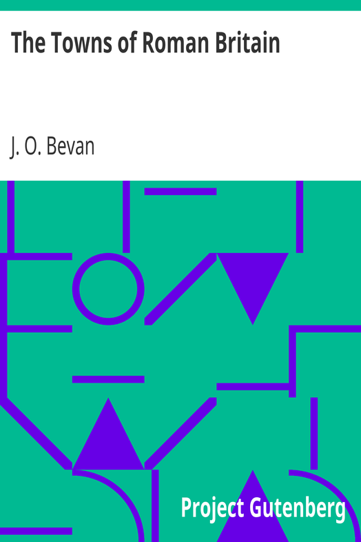
| Roman Britain shewing the chief Roman Roads. |
THE TOWNS OF ROMAN BRITAIN
Rev. J. O. Bevan,
Fellow of the College of Preceptors and
Examiner, Sometime Prizeman, Exhibitioner and
Foundation Scholar of Emmanuel College, Cambridge.
"The Genesis and Evolution of the Individual Soul"
"Egypt and the Egyptians"
"University Life in the Middle Ages"
"Handbook of the History and Development of Philosophy"
"Archæological Map of Herefordshire"
and numerous other Works.
Chapman & Hall, Ltd.
[All Rights Reserved]
411A HARROW ROAD
LONDON W
PREFACE
The Author writes the last line of this book with a sigh at the incompleteness of his work. He is conscious he has touched but the fringe of the mantle covering the form of the silent Muse of History, but his efforts will be justified if he succeeds in persuading even a single student to persevere and lead the fair Clio to disclose the full story of which broken whispers are here recorded. No one can doubt the fascination of this page of our nation's development, dealing as it does with the dawn of that day of which, please God, the complete effulgence will shine more and more to the perfect end.
In this brochure attention has been chiefly directed to the towns of Roman Britain, as it would have required a volume of stupendous size to formulate a record of sites associated with isolated settlements, camps, burrows, "and bowers," or grounds whereon sports were conducted. Again, there are spots of interest more or less connected with Roman occupation, in tradition or in fact, such as Alderney,1 Porchester,2 Glastonbury, Avebury, Arbow Low in Derbyshire, Stripple Stones, on Bodmin Moor, in Cornwall, the hill-fort in Parc-y-meirch Wood, Dinorben, Denbighshire. The line we have been compelled to draw necessarily excludes such as these. The present work is intended to furnish a compendious guide to readers who desire to study the fruits of the Roman occupation, to trace out the roads they laid down, and to possess themselves of the position and essential features of the centres where they congregated for commerce, pleasure, or defence. The Author has long been attracted to the elucidation of the early history of Britain, and this feeling was intensified by the work he undertook some years ago in connection with the compilation of an Archæological Map of Herefordshire, on lines laid down by the Society of Antiquaries. His experience at that time made him aware how such an undertaking might serve to quicken the curiosity, and to whet the expectation of the student of old time as to the wonderful secrets which await the skilful use of such humble implements as the shovel and the pick in almost any quarter of our island home.
1 Alderney (Ald, old; Ey, island). This, the most northerly of the four Channel Islands seems to have been known to the Romans as Riduna. Remains of ancient dwellings have been found there.
2 To the north of Portsmouth Harbour is situated Porchester Castle, a ruined Norman fortress, occupying the site of the Portus Magnus of the Romans.
The Author desires to convey his acknowledgments to Messrs. Philip and Son, Ltd., of Fleet Street, for their kindness in permitting him to make use of the blocks for the two Maps which appear in this volume.
CHILLENDEN RECTORY,
CANTERBURY.
Nov., 1916.
TABLE OF CONTENTS
TABLE OF MAPS.
INTRODUCTION
HISTORICAL SKETCH.
The earliest notice of Britain is in Herodotus (B.C. 480-408); but he mentions the Tin Islands (Scilly Islands and Cornwall), only to confess his ignorance about them. More important is a passage in Aristotle (B.C. 384-322), who (writing a century later) is the earliest author who mentions the British Isles by name, as he does in the following passage: "Beyond the Pillars of Hercules (the Strait of Gibraltar) the ocean flows round the earth, and in it are two very large islands (Nesoi Britannikoi), called in British Albion and Ierne, lying beyond the Keltoi." The application of the name Britannia to denote the larger island, is due to Julius Cæsar (B.C. 100-44), who is the first Roman writer to mention Britain. The name itself may be derived from Welsh, brith, mottled, tattooed, or from brithyn, cloth, cloth-clad, as opposed to the skin-clad Celts.
The history of Britain would be a very long one if we only knew it. It is clear that a considerable interchange of commerce was carried on between the south-eastern parts of the island and Gaul, and that even the remoter regions of the Mediterranean were largely dependent upon Britain for their supplies of tin from the Cornish mines, of lead from Somerset, and of iron from Northumberland and the Forest of Dean.
Politically, Britain consisted of a number of independent bodies, united in a federation of the loosest kind, in which the lead was taken by that tribe which happened at the time to be the most powerful or to have the bravest or most astute leader.
About B.C. 56 Caius Volusenus was sent to this country by Julius Cæsar to examine the coast preparatory to an invasion. The step was threatened, because it was alleged that the Britons had aided and abetted some of the Gaulish tribes in their resistance to the Roman domination. On August 26th, B.C. 55, Cæsar himself set sail from Portus Itius, near Boulogne, with two legions, and effected a landing, presumably near Deal. A good deal of discussion has taken place relative to this point, and much has been said as to the action of the winds and tides in determining his landing place. Probably he would have made a feint at Dover and one or two other places, under cover of which the main body would land at a spot weakly defended. At all events, the resistance offered by the British was soon overcome, easy terms being imposed on their submission. Soon after, Cæsar left, but early in the following summer he again invaded these shores with five legions and two thousand cavalry. He landed in the same neighbourhood as before, and advanced 12 miles inland to the river Stour before meeting with the islanders. Ultimately he decisively defeated Cassivelaunus, the leader, either near London or his capital, Verulamium. The conqueror departed at the fall of the year, without leaving behind any garrison, but, at the same time, taking away hostages to ensure the carrying out of the terms imposed.
Then ensues a period during which direct Roman influence of a dominant or military character fell into abeyance, so that one is required to take up the tale at a much later period, viz., the accession of Claudius, in A.D. 41. That emperor determined to carry out the intention of Augustus to exact the promised tribute from Britain. In 43 he despatched Aulus Plautius with four legions, who obtained an easy victory. Claudius himself received the submission of the tribes. In 42, Vespasian also—who afterwards became emperor in 69—was warring against the Silurian chief, Caradog, or Caractacus (a son of Cunobelin). The latter was defeated in 50 by P. Ostorius Scapula, and found refuge in the country of Cartismandua, queen of the Brigantes, who, however, ultimately gave up her prisoner.
There is a tradition embodied in the Welsh Triads that Caradog and his wife were taken to Rome, and that three hostages accompanied them, by name Bran, Llin, and Claudia, respectively the father, son, and daughter of the brave British chieftain. It is further surmised that Llin and Claudia were the Linus and Claudia referred to by St. Paul in 2 Tim. iv, 21, and that Bran, after seven years banishment at Rome—where he embraced Christianity under the influence of the great Apostle of the Gentiles—returned to his native land to proclaim the new religion to the people.
In 61, Boadicea, Queen of the Iceni, revolted against the Roman yoke, sacked London and Colchester, but was defeated near the former city, and took poison rather than fall into the hands of the victors. Agricola became governor in 78, and subjected to his rule the Ordovices Nivales. Not long after, he attacked the Brigantes and Galgacus. In 120, Hadrian was engaged in building the Roman or Pict wall between the Tyne and Solway Frith, which has for so long borne his name. Nineteen years later, Tollius Urbicus constructed the rampart, called the Wall of Antonine (Antoninus Pius 86-161), along the line of Agricola's forts, built between the Forth and the Clyde, to overawe the wild tribes to the north. This wall is now known by the name of Graeme's Dyke. In 207 onwards, Severus built a new wall along the line of Hadrian's rampart. He died at York in 211. The years 287, 288, saw the reigns of Carausius and Allectus. In 296, Constantius Chlorus regained Britain for Rome. He also died at York in 306. In 307 the Picts and Scots overran the country as far as London. The General Theodosius was sent to oppose them, and drove them back beyond Valentia, the fifth Roman division northwards. The title of Emperor was assumed by Maximus in 383, but he was put to death in 388. Stilicho, the general of Honorius, transferred one legion from Britain into Gaul. This weakened the defence of the land against the northern tribes, as the legion never returned. At this epoch ever-growing confusion and division manifested themselves within the Roman Empire, whereupon its hold on distant provinces grew weaker and weaker. At one period there were as many as six Emperors contending with one another for the sole authority; and in 410, the year in which Rome was sacked by the Goths under Alaric, the Roman occupation was terminated according to the terms of a letter addressed by Honorius to the cities of Britain.
EARLY HISTORY.
Nothing very specific can be said about the settlements of the Celtic inhabitants of these islands before the coming of Cæsar. The country must have been largely covered by forests and intersected by fens. Different tribes occupied different centres and were nomadic according to the season of the year. Barter was common, and there must have been facilities for the distribution of those goods which had their origin in Gaul. An export trade, too, was actively carried on in regard to such metals as tin, which were borne in rude conveyances along well-defined trackways wrought out along the sheltered sides of hills.
Certain spots—woods, hills, wells—from their size, shape, position, or some accidental association, were regarded as sacred, and became the centres of religious worship, of sacrifice, and of schools of priests. Thus we have—then, or in somewhat later times—Bangor, Mona, or the Isle of Augury, Stonehenge, Avebury, etc.
The coming of the Romans led to the opening up of new roads, and caused the building of walls of defence against predatory tribes. It also accentuated the position of many of the camps, centres of population, and strategic posts.
MAIN DIVISIONS.
In the reign of Claudius (B.C. 41-A.D. 54), the country south of the Solway Frith and the mouth of the Tyne formed one Roman province under a consular legate and a procurator. Ptolemy (fl. 139-162) (who flourished at Alexandria, and was one of the greatest of ancient geographers) mentions 17 native tribes as inhabiting this district. The Emperor Severus (146-211) divided the whole into two parts, Britannia Inferior, the south, and Britannia Superior, the north. In the division of the country under Diocletian, Britain was made a diocese in the prefecture of Gaul, and was governed by a vicarius, residing at York. It was split up into five provinces, of which the boundaries, though somewhat uncertain, are supposed to have been as follows:
Britannia Prima—the country south of the Thames and of the Bristol Channel.
Britannia Secunda—Wales.
Flavia Caesariensis—the country between the rivers Thames, Severn, Mersey, and Humber.
Maxima Caesariensis—the rest of England, up to the wall of Hadrian.
Valentia (soon abandoned by the Romans), Scotland south of the Wall of Antoninus.
To ensure the obedience of the natives, various Roman legions, composed of Gauls, Germans, Iberians, rather than of pure Romans, were stationed in Britain, viz., at such places as Eboracum (York), Deva (Chester), Isca (Caerleon), and Magni, or Magna (Kenchester).1
1 In the Itinerary, as in the Ravenna Geographer, we have only the form Magnis, presumably from a nominative Magni, or Magna.
ROMAN BRITAIN.
The population of Roman Britain was, in the main Celtic; the Cymric division predominating in the south and east, the Gaidhelic in the north and west. There existed, besides these, remnants of two earlier races—a small dark-haired race, akin to the Basques, or Euskarian (found in S.W. England, S. Wales,2 and parts of the Scotch Highlands), and a tall, fairhaired race.
Under the Romans, many towns (coloniae and municipia) were founded. In several cases their position had been occupied, as winter or summer quarters, by the aboriginal inhabitants; the choice of the site being determined by the contour of the hills, the convergence of trackways, or the proximity to the sea or rivers. Fifty-six Roman towns are enumerated by Claudius Ptolemy (fl. A.D. 139-162). They formed centres of Roman authority, law, commerce, and civilization; the conquerors, to a very limited extent, were able to introduce their own literature. Amongst others, the free inhabitants of Eboracum and Verulamium enjoyed the coveted rights of Roman citizenship. The Ravenna Geographer gives a list of towns—the names of some of which being difficult to identify. Principally to ensure military dominance, the conquerors made many main roads, mostly centering in London. They also developed the land into a corn-growing country.
The history of the towns that became Roman is known to us very imperfectly and unevenly, in respect of elements earlier than the conquest of A.D. 43; of the beginnings, whether official or personal; of their size, original planning, character and composition of the buildings, of the language, degree of civilization, and comparative wealth of the inhabitants; of the relation of the town-life to the life of the adjacent country-side. Further, great mystery shrouds the particulars of their overthrow when the aegis of the Roman authority was withdrawn. There are but few survivals of towns to the present day, and parallels must be sought rather in Pannonia3 and North Africa than in the Western European Empire.
3 Now Illyria, a part of Hungary; finally subdued by Tiberius, A.D. 8.