Yellowstone River plummets through the famous Grand Canyon of Yellowstone. Carved by the river, the “yellow” rocks of the canyon are rhyolite lava flows that have been altered by hot water. The lava flows were erupted after the most recent caldera-forming eruption about 600,000 years ago.
Long Valley Caldera, California.
Long Valley Caldera lies on the eastern front of the Sierra Nevada, about 300 kilometers east of San Francisco. A huge explosive eruption about 700,000 years ago formed the caldera and produced pyroclastic flows that traveled 65 kilometers from the vent and covered an area of about 1,500 square kilometers. Ash from the caldera-forming eruption fell as far east as Nebraska. Within the past 40,000 years, eruptions have been restricted to a linear zone of vents, including the Mono-Inyo Craters Volcanic Chain, that extends about 50 kilometers north from the northwest part of the caldera.
This volcanic chain consists of many vents that have erupted in the past several thousand years. Eruptions from vents as recently as 550 years ago produced lava flows, pyroclastic flows, and ash, all of rhyolitic composition. Geologic mapping shows that some eruptions were preceded by ground cracking, suggesting that the ground was pulled apart or stretched as magma neared the surface.
Sketch of Long Valley Caldera and the Mono-Inyo Craters Volcanic Chain in central California, viewed from the southeast. (Sketch by Tau Rho Alpha.)
- Sierra Nevada
- Mono craters
- Inyo craters
- Mammoth Lakes
- Resurgent dome
- Long Valley Caldera
Three moderate earthquakes south of the caldera and one beneath the caldera on May 25-26, 1980, marked the beginning of unrest that continues into the 1990’s. Swarms of earthquakes beneath the caldera, changes in several hot springs, and the formation of new springs have occurred since 1980. Precise surveys have also shown that the central part of the caldera has risen by more than 50 centimeters since 1975. This unrest is probably related to the stretching (east-west extension) of the Earth’s crust that is known to be occurring in the region around the caldera, and it probably also involves the rise of magma beneath the caldera. Scientists do not know if this unrest will lead to volcanic activity, but the geologically recent eruptions along the Mono-Inyo Craters Volcanic Chain suggest that future eruptions are possible.
South Inyo Crater, Long Valley Caldera, California. Explosive eruptions formed the crater about 500 years ago. (Photograph by Steven R. Brantley.)
Yellowstone Caldera, Yellowstone National Park, Wyoming.
Yellowstone Caldera is one of the largest and most active calderas in the world. The spectacular geysers, boiling hot springs, and mud pots that have made Yellowstone famous—and even the strikingly beautiful Grand Canyon of Yellowstone through which the Yellowstone River plunges—owe their existence to the tremendous volcanic forces that have affected the region during the past 2 million years. Cataclysmic eruptions 2.0, 1.3, and 0.6 million years ago ejected huge volumes of rhyolite magma; each eruption formed a caldera and extensive layers of thick pyroclastic-flow deposits. The youngest caldera is an elliptical depression, nearly 80 kilometers long and 50 kilometers wide, that occupies much of Yellowstone National Park. The caldera is buried by several extensive rhyolite lava flows erupted between 75,000 and 150,000 years ago.
Map of most recent Yellowstone Caldera and its main thermal features. After the caldera formed, many vents erupted thick rhyolite lava flows, and the central part of the caldera was pushed upward to form resurgent domes. The star marks the magnitude 7.5 Hebger Lake earthquake.
- IDAHO
- Hebgen Lake
- West Yellowstone
- MONTANA
- Silver Gate
- Gardiner
- WYOMING
- Yellowstone National Park
- Mammoth
- M 7.5 Aug. 18 1959
- Norris Geyser Basin
- Mud Pots
- Old Faithful
- West Thumb Geyser Basin
- Yellowstone Lake
- CALDERA RIM
- COLORADO
- Resurgent dome
The Earth’s crust beneath Yellowstone National Park is still restless. Precise surveys have detected an area in the center of the caldera that rose by as much as 86 centimeters between 1923 and 1984 and then subsided slightly between 1985 and 1989. Scientists do not know the cause of these ups and downs but hypothesize that they are related to the addition or withdrawal of magma beneath the caldera, or to the changing pressure of the hot ground water system above Yellowstone’s large magma reservoir. Also, Yellowstone National Park and the area immediately west of the Park are historically among the most seismically active areas in the Rocky Mountains. Small-magnitude earthquakes are common beneath the entire caldera, but most are located along the Hebgen Lake fault zone that extends into the northwest part of the caldera. A magnitude 7.5 earthquake occurred along this zone in 1959.
Castle Geyser erupting a column of hot water, Yellowstone National Park. (Photograph by Steven R. Brantley.)
Active Volcanoes: Windows Into the Past
Molten rock has erupted onto the surface of the Earth throughout its 4.5-billion-year history. Although many of these ancient rocks were removed by erosion, volcanic deposits can be found beneath younger rocks in many parts of the United States. To a geologist, such long-lasting volcanic rocks look like those formed by today’s active volcanoes. Many ancient volcanic rocks, however, change somewhat with time, as they become firmly consolidated, buried by younger deposits, and sometimes folded and faulted by the continuous shifting of the Earth’s crust. Even minerals of volcanic rocks may change, if after burial they encounter high pressures and temperatures.
Columnar jointing in an ancient lava flow in the Blue Ridge Mountains, Shenandoah National Park, Virginia. The flow that contains the columns is one of an extensive series of lava flows, each averaging about 200 feet thick, that poured over the land more than 570 million years ago. Columns form as cooling or shrinkage joints when a hot lava flow cools quickly; the columns form perpendicular to the cooling surface. These columns are about .5 meter in diameter. (Photograph by J.C. Reed, Jr.)
Most active volcanoes are built on older volcanic deposits erupted from ancient volcanoes, and visitors to the present-day volcanoes walk or drive across these products of past volcanism. For example, anyone driving across the Cascade Range, sunbathing at Waikiki, or fishing on the Alaska Peninsula is there because old volcanic rocks form the landscape.
One step further back in time from today’s active volcanoes are people who picnic in the White Mountains of New Hampshire, enjoy the autumn colors in the Blue Ridge of Shenandoah National Park, and hike in the rugged Big Bend National Park of Texas. Many of the rocks in these areas were formed by eruptions or by intrusion of magma into the Earth’s crust many millions of years ago. Because volcanic activity has been so important in shaping the Earth, watching active volcanoes today provides a window through which we can glimpse and reconstruct the early volcanic history of our planet.
As we increase our knowledge about volcanic processes, by studying volcanoes erupting today as well as those that have lain dormant for hundreds to thousands of years, we increase our ability to predict when and how volcanoes will erupt. Accurate predictions, presented in terms that are meaningful to public officials, will minimize the number of lives lost and the social and economic upheaval that an eruption can cause.
Thick layers of volcanic rocks form the Superstition Mountains, located about 60 kilometers east of Phoenix, Arizona. The consolidated deposits of pyroclastic flows, lava flows and domes, and lahars in the Superstition Mountains and adjacent areas testify to a period of intense volcanism about 17 to 25 million years ago in central Arizona. (Photograph by D.W. Peterson.)
Glossary
| Andesite | A volcanic rock containing 53-63% silica with a moderate viscosity when in a molten state. |
| Ash | Fragments less than 2 millimeters in diameter of lava or rock blasted into the air by volcanic explosions. |
| Basalt | A volcanic rock consisting of less than 53% silica with a low viscosity when in a molten state. |
| Caldera | A large volcanic depression, commonly circular or elliptical when seen from above. |
| Composite volcano | A steep-sided volcano composed of many layers of volcanic rocks, usually of high-viscosity lava and fragmented debris such as lahar and pyroclastic deposits. |
| Dacite | A volcanic rock containing 63-68% silica with a high viscosity when in a molten state. |
| Dome | A steep-sided mound that forms when viscous lava piles up near a volcanic vent. Domes are formed by andesite, dacite, and rhyolite lavas. |
| Fumarole | A vent that releases volcanic gases, including water vapor (steam). |
| Lahar | A flowing mixture of water and rock debris that forms on the slopes of a volcano, sometimes referred to as debris flow or mudflow. The term comes from Indonesia. |
| Lava | Molten rock that erupts from a vent or fissure; see magma. |
| Magma | Molten rock that contains dissolved gas and crystals, formed deep within the Earth. When magma reaches the surface, it is called lava. |
| Phreatic eruption | A type of volcanic explosion that occurs when water comes in contact with hot rocks or ash near a volcanic vent, causing steam explosions. |
| Pumice | A light-colored volcanic rock containing abundant trapped gas bubbles formed by the explosive eruption of magma. Because of its numerous gas bubbles, pumice commonly floats on water. |
| Pyroclastic flow | A hot, fast-moving and high-density mixture of ash, pumice, rock fragments, and gas formed during explosive eruptions. |
| Pyroclastic surge | Same process as pyroclastic flow but of much lower density. |
| Rhyolite | A volcanic rock containing more than 68% silica with a very high viscosity when in a molten state. |
| Shield volcano | A volcano shaped like an inverted warrior’s shield with long gentle slopes produced by eruptions of low-viscosity basaltic lava. |
| Silica | The molecule formed of silicon and oxygen (SiO₂) that is the basic building block of volcanic rocks and the most important factor controlling the fluidity of magma. The higher a magma’s silica content, the greater its viscosity or “stickiness.” |
| Vent | The opening at the Earth’s surface through which volcanic materials (magma and gas) escape. |
| Volcano | A vent in the surface of the Earth through which magma erupts and also the landform that is constructed by the erupted material. |
| Volcanic landslide | The downslope movement of soil, rock debris, and sometimes glacial ice, with or without water, from the flank of a volcano. |
Scientist surveying lava dome at Redoubt Volcano. (Photograph by G. McGimsey.)
The metric units used in this publication can be converted to English units by using the approximate conversions given below:
| Length | |
|---|---|
| 1 kilometer | 0.6 of a mile |
| 1 meter | 39.37 inches |
| 1 centimeter | 0.4 inch |
| 1 millimeter | 0.04 inch |
| Area | |
| 1 sq. kilometer | 0.4 sq. mile |
| 1 sq. meter | 1.2 sq. yards |
| 1 sq. centimeter | 0.155 sq. inch |
| Temperature | |
| To convert °Celsius to °Fahrenheit, multiply °C by 1.8 and add 32. | |
| To convert °Fahrenheit to °Celsius, subtract 32 from °F and divide the result by 1.8. | |
Further Reading
Decker, Robert, and Decker, Barbara, 1989, Volcanoes: San Francisco, Freeman, 285 p. (An information-packed introduction to the study of volcanoes written in an easy-to-read style.)
Editors, 1982, Volcano: in the series Planet Earth, Alexandria, Virginia, Time-Life Books, 176 p. (A well illustrated and readable general survey of volcanoes and their activity.)
McClelland, Lindsay, Simkin, Tom, Summers, Marjorie, Nielsen, Elizabeth, and Stein, T.C., editors, 1989, Global Volcanism 1975-1985: Englewood Cliffs, New Jersey, Prentice-Hall, 656 p. (A full account of volcanism on Earth based on eyewitness accounts from geologists and other scientists, reporters, travelers, and other keen observers.)
Simkin, Tom, and Seibert, Lee, 1994, Volcanoes of the World (Second edition): Stroudsburg, Pa., Hutchinson Ross, 233 p. (A comprehensive regional directory of worldwide volcanic activity during the past 10,000 years; activity presented in table format.)
Tilling, R. I., 1982, Volcanoes: Reston, Virginia, U.S. Geological Survey general-interest publication, 46 p. (A general introduction for the nonspecialist to the study of volcanoes, with focus on the nature, types, workings, products, and hazards of volcanoes.)
Tilling, R. I., 1984, Eruptions of Mount St. Helens: Past, present, and future: Reston, Virginia, U.S. Geological Survey general-interest publication, 46 p. (A nontechnical summary, illustrated by many color photographs and diagrams, of the abundant scientific data available for the volcano, with emphasis on the catastrophic eruption on May 18, 1980, which caused the worst volcanic disaster in U.S. history.)
Tilling, R. I., 1987, Eruptions of Hawaiian volcanoes: Past, present, and future: Reston, Virginia, U.S. Geological Survey general-interest publication, 54 p. (A nontechnical summary, illustrated by color photographs and drawings, of the eruption history, style, and products of two of Hawaii’s active volcanoes, Kilauea and Mauna Loa.)
Wood, C. A., and Kienle, Jurgen, editors, 1990, Volcanoes of North America—United States and Canada: Cambridge University Press, 354 p. (A rich compilation of volcanoes and volcanic fields in North America that were formed in the past 5 million years; includes more than 250 entries prepared by leading experts in volcanology.)
U.S. Geological Survey
Information Services
P.O. Box 25286
Denver, CO 80225
U.S. GOVERNMENT PRINTING OFFICE: 1996 421-555
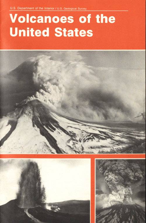
Front and back cover (clockwise from top photograph on front) Augustine Volcano, Alaska, 1986.
Mount St. Helens, Washington, 1980.
Kilauea Volcano, Hawaii, 1983.
Mount Spurr, Alaska, 1992.
Mono-Inyo Craters Volcanic Chain inside Long Valley Caldera, California.
As the Nation’s principal conservation agency, the Department of the Interior has responsibility for most of our nationally owned public lands and natural and cultural resources. This includes fostering sound use of our land and water resources; protecting our fish, wildlife, and biological diversity; preserving the environmental and cultural values of our national parks and historical places; and providing for the enjoyment of life through outdoor recreation The Department assesses our energy and mineral resources and works to ensure that their development is in the best interests of all our people by encouraging stewardship and citizen participation in their care. The Department also has a major responsibility for American Indian reservation communities and for people who live in island territories under U S administration.
Transcriber’s Notes
- Retained publication information from the printed edition: this eBook is public-domain in the country of publication.
- In the text versions only, text in italics is delimited by _underscores_.
- In the ASCII version only, subscripted numbers are preceded by underscore and delimited by brackets.