The Project Gutenberg eBook of The Illustrated Works of Gordon Home: A Linked Index to the Project Gutenberg Editions
This ebook is for the use of anyone anywhere in the United States and
most other parts of the world at no cost and with almost no restrictions
whatsoever. You may copy it, give it away or re-use it under the terms
of the Project Gutenberg License included with this ebook or online
at www.gutenberg.org. If you are not located in the United States,
you will have to check the laws of the country where you are located
before using this eBook.
Title: The Illustrated Works of Gordon Home: A Linked Index to the Project Gutenberg Editions
Author: Gordon Home
Editor: David Widger
Release date: May 24, 2009 [eBook #28959]
Most recently updated: November 12, 2023
Language: English
Credits: Produced by David Widger
*** START OF THE PROJECT GUTENBERG EBOOK THE ILLUSTRATED WORKS OF GORDON HOME: A LINKED INDEX TO THE PROJECT GUTENBERG EDITIONS ***
INDEX OF THE ILLUSTRATED WORKS OF
GORDON HOME
Author and Painter
AN ON-LINE INDEX
Edited by David Widger
Gordon Home (1878-1969)
Project Gutenberg Editions
CONTENTS
Click on the ## before each title to go directly to a
linked index of the detailed chapters and illustrations
VOLUMES, CHAPTERS AND STORIES
Normandy
| PREFACE | |
| LIST OF COLOURED ILLUSTRATIONS | |
| LIST OF LINE ILLUSTRATIONS | |
| CHAPTER I | Some Features of Normandy |
| CHAPTER II | By the Banks of the Seine |
| CHAPTER III | Concerning Rouen, the Ancient Capital of Normandy |
| CHAPTER IV | Concerning the Cathedral City of Evreux and the Road to Bernay |
| CHAPTER V | Concerning Lisieux and the Romantic Town of Falaise |
| CHAPTER VI | From Argentan to Avranches |
| CHAPTER VII | Concerning Mont St Michel |
| CHAPTER VIII | Concerning Coutances and Some Parts of the Cotentin |
| CHAPTER IX | Concerning St Lo and Bayeux |
| CHAPTER X | Concerning Caen and the Coast Towards Trouville |
| CHAPTER XI | Some Notes on the History of Normandy |
LIST OF COLOURED ILLUSTRATIONS
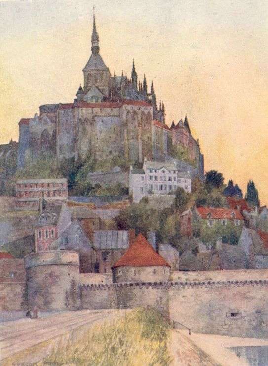
| MONT ST MICHEL FROM THE CAUSEWAY |
| ON THE ROAD BETWEEN CONCHES AND BEAUMONT-LE-ROGER This is typical of the poplar-bordered roads of Normandy. |
| THE CHATEAU GAILLARD FROM THE ROAD BY THE SEINE The village of Le Petit Andely appears below the castle rock, and is partly hidden by the island. The chalk cliffs on the left often look like ruined walls. |
| A TYPICAL REACH OF THE SEINE BETWEEN ROUEN AND LE PETIT ANDELY On one side great chalk cliffs rise precipitously, and on the other are broad flat pastures. |
| THE CHURCH AT GISORS, SEEN FROM THE WALLS OF THE NORMAN CASTLE |
| THE TOUR DE LA GROSSE HORLOGE, ROUEN It is the Belfry of the City, and was commenced in 1389. |
| THE CATHEDRAL AT ROUEN Showing a peep of the Portail de la Calende, and some of the quaint houses of the oldest part of the City. |
| THE CATHEDRAL OF EVREUX SEEN FROM ABOVE On the right, just where the light touches some of the roofs of the houses, the fine old belfry can be seen. |
| A TYPICAL FARMYARD SCENE IN NORMANDY The curious little thatched mushroom above the cart is to be found in most of the Norman farms. |
| THE BRIDGE AT BEAUMONT-LE-ROGER On the steep hill beyond stands the ruined abbey church. |
| IN THE RUE AUX FEVRES, LISIEUX The second tiled gable from the left belongs to the fine sixteenth century house called the Manoir de Francois I. |
| THE CHURCH OF ST JACQUES AT LISIEUX One of the quaint umber fronted houses for which the town is famous appears on the left. |
| FALAISE CASTLE The favourite stronghold of William the Conqueror. |
| THE PORTE DES CORDELIERS AT FALAISE A thirteenth century gateway that overlooks the steep valley of the Ante. |
| THE CHATEAU D'O A seventeenth century manor house surrounded by a wide moat. |
| THE GREAT VIEW OVER THE FORESTS TO THE SOUTH FROM THE RAMPARTS OF DOMFRONT CASTLE Down below can be seen the river Varennes, and to the left of the railway the little Norman Church of Notre-Dame-sur-l'Eau. |
| THE CLOCK GATE, VIRE |
| A VIEW OF MONT ST MICHEL AND THE BAY OF CANCALE FROM THE JARDIN DES PLANTES AT AVRANCHES On the left is the low coast-line of Normandy, and on the right appears the islet of Tombelaine. |
| THE LONG MAIN STREET OF COUTANCES In the foreground is the Church of St Pierre, and in the distance is the Cathedral. |
| THE GREAT WESTERN TOWERS OF THE CHURCH OF NOTRE DAME AT ST LO They are of different dates, and differ in the arcading and other ornament. |
| THE NORMAN TOWERS OF BAYEUX CATHEDRAL |
| OUISTREHAM |
LIST OF LINE ILLUSTRATIONS
| THE CHATELET AND LA MERVEILLE AT MONT ST MICHEL The dark opening through the archway on the left is the main entrance to the Abbey. On the right can be seen the tall narrow windows that light the three floors of Abbot Jourdain's great work. |
| THE DISUSED CHURCH OF ST NICHOLAS AT CAEN |
| A COURTYARD IN THE RUE DE BAYEUX AT CAEN |
Yorkshire
ILLUSTRATIONS
| York from the Central Tower of The Minster |
| Sleights Moor from Swart Houe Cross |
| Runswick Bay |
| Robin Hood's Bay |
| Sunrise from Staithes Beck |
| The Red Roofs of Whitby |
| Whitby Abbey from the Cliffs |
| An Autumn Day at Guisborough |
| The Skelton Valley |
| In Pickering Church |
| The Market-place, Helmsley |
| Richmond Castle from the River |
| A Rugged View Above Wensleydale |
| A Jacobean House at Askrigg |
| Aysgarth Force |
| View up Wensleydale from Leyburn Shawl |
| Ripon Minster from the South |
| Fountains Abbey |
| Knaresborough |
| Bolton Abbey, Wharfedale |
| Settle |
| Wolds |
| Filey Brig |
| The Outermost Point of Flamborough Head |
| Hornsea Mere |
| The Market-place, Beverley |
| Patrington Church |
| Coxwold Village |
| The West Front of the Church Of Byland Abbey |
| Bootham Bar, York |
| Kirkstall Abbey, Leeds |
Yorkshire—Coast and Moorlands
| CHAPTER I | ACROSS THE MOORS FROM PICKERING TO WHITBY |
| CHAPTER II | ALONG THE ESK VALLEY |
| CHAPTER III | THE COAST FROM WHITBY TO REDCAR |
| CHAPTER IV | THE COAST FROM WHITBY TO SCARBOROUGH |
| CHAPTER V | SCARBOROUGH |
| CHAPTER VI | WHITBY |
| CHAPTER VII | THE CLEVELAND HILLS |
| CHAPTER VIII | GUISBOROUGH AND THE SKELTON VALLEY |
| CHAPTER IX | FROM PICKERING TO RIEVAULX ABBEY |
England of My Heart—Spring
|
|
LIST OF ILLUSTRATIONS
| Shooters' Hill |
| Dartford Church and Bridge |
| The Gateway of the Monastery Close, Rochester |
| Rochester |
| Canterbury Cathedral from Christchurch Gate |
| West Gate, Canterbury |
| On the Stour Near Canterbury |
| Chilham |
| A Corner of Romney Marsh |
| Rye |
| Winchelsea Church |
| Battle Abbey |
| Lewes Castle |
| The Downs |
| The Weald of Sussex, North Of Lewes |
| Arundel Castle |
| The Market Cross, Chichester |
| Bosham |
| The Tudor House, Opposite St Michael's Church, Southampton |
| In the New Forest |
| Romsey Abbey |
| North Transept, Winchester Cathedral |
| St Cross, Winchester |
| Selborne from the Hanger |
Beautiful Britain
| CHAPTER | PAGE | |
|---|---|---|
| I. | THE PILGRIM'S APPROACH TO THE CITY | 5 |
| II. | THE STORY OF CANTERBURY | 9 |
| III. | THE CATHEDRAL | 40 |
| IV. | THE CITY | 56 |
| INDEX | ||
LIST OF ILLUSTRATIONS
| PLATE | ||
|---|---|---|
| 1. | THE NAVE OF CANTERBURY CATHEDRAL | Frontispiece |
| FACING PAGE | ||
| 2. | CHRIST CHURCH GATE | 9 |
| 3. | THE CATHEDRAL FROM NORTH-WEST | 16 |
| 4. | THE "ANGEL" OR "BELL HARRY" TOWER AND THE LAVATORY TOWER OF THE CATHEDRAL | 25 |
| 5. | THE CHAPEL OF "OUR LADY" IN THE UNDERCROFT OF THE CATHEDRAL | 27 |
| 6. | THE WARRIOR'S CHAPEL | 30 |
| 7. | THE MARTYRDOM IN THE NORTH-WEST TRANSEPT | 32 |
| 8. | THE DOORWAY FROM THE CLOISTERS TO THE MARTYRDOM | 43 |
| 9. | THE GREYFRIARS' HOUSE IN CANTERBURY | 46 |
| 10. | THE HOUSE OF THE CANTERBURY WEAVERS | 49 |
| 11. | WESTGATE CANTERBURY FROM WITHIN | 56 |
| 12. | THE NORMAN STAIRCASE TO THE KING'S SCHOOL | On the cover |
| 13. | PLAN OF CANTERBURY. | 5 |
| 14. | PLAN OF CANTERBURY CASTLE. | 63 |
The Evolution Of An English Town
| PREFACE. |
| LIST OF ILLUSTRATIONS. |
| INTRODUCTION |
| CHAPTER I CONCERNING THOSE WHICH FOLLOW |
| CHAPTER II THE FOREST AND VALE OF PICKERING IN PALAEOLITHIC AND PRE-GLACIAL TIMES |
| CHAPTER III THE VALE OF PICKERING IN THE LESSER ICE AGE |
| CHAPTER IV THE EARLY INHABITANTS OF THE FOREST AND VALE OF PICKERING |
| CHAPTER V HOW THE ROMAN OCCUPATION OF BRITAIN AFFECTED THE FOREST AND VALE OF PICKERING, B.C. 55 TO A.D. 418 |
| CHAPTER VI THE FOREST AND VALE IN SAXON TIMES, A.D. 418 TO 1066 |
| CHAPTER VII THE FOREST AND VALE IN NORMAN TIMES, A.D. 1066 TO 1154 |
| CHAPTER VIII THE FOREST AND VALE IN THE TIME OF THE PLANTAGENETS, A.D. 1154 TO 1485 |
| CHAPTER IX THE FOREST AND VALE IN TUDOR TIMES, A.D. 1485 TO 1603 |
| CHAPTER X THE FOREST AND VALE IN STUART TIMES, A.D. 1603 TO 1714 |
| CHAPTER XI THE FOREST AND VALE IN GEORGIAN TIMES, A.D. 1714 TO 1837 |
| CHAPTER XII THE FOREST AND VALE FROM EARLY VICTORIAN TIMES UP TO THE PRESENT DAY, A.D. 1837 TO 1905 |
| CHAPTER XIII Concerning the Villages and Scenery of the Forest and Vale of Pickering |
| CHAPTER XIV Concerning the Zoology of the Forest and Vale |
LIST OF ILLUSTRATIONS
| Pickering From The North-West |
| Rosamund Tower, Pickering Castle |
| Kirkdale Cave |
| Hyænas' Jaws |
| Elephants' Teeth |
| Bear's Tusk |
| Pickering Lake in Ice Age |
| Newtondale in Ice Age |
| Pickering Lake, Eastern End |
| Scamridge Dykes |
| Pre-Historic Weapons |
| Leaf-shaped Arrow Head |
| Lake Dwellings Relics |
| Remains of Pre-Historic Animals from Lake Dwellings |
| Skeleton of Bronze Age |
| A Quern |
| Urns in Pickering Museum |
| Sketch Map of Roman Road and Camps |
| The Tower of Middleton Church |
| Ancient Font and Crosses |
| Saxon Sundial at Kirkdale |
| Saxon Sundial at Edstone |
| Pre-Norman Remains near Pickering |
| Saxon Stones at Kirkdale |
| Saxon Stones at Sinnington |
| South Side of the Nave of Pickering Church |
| Norman Doorway at Salton |
| Norman Work at Ellerburne |
| The Crypt at Lastingham |
| Norman Font at Edstone |
| Wall Paintings in Pickering Church |
| The Devil's Tower, Pickering Castle |
| Wall Painting of St Christopher |
| Wall Painting of St Edmund and Acts of Mercy |
| Wall Painting of Herod's Feast and Martyrdom of St Thomas a Becket |
| Effigy of Sir William Bruce |
| Effigies in Bruce Chapel |
| Holy Water Stoup in Pickering Church |
| Sanctus Bell |
| Cattle Marks |
| Section of Fork Cottage |
| Details of Fork Cottage |
| Pickering Castle from the Keep |
| Pre-Reformation Chalice |
| Font at Pickering Church |
| Alms Box at Pickering Church |
| House in which Duke of Buckingham Died |
| Maypole on Sinnington Green |
| Inverted Stone Coffin at Wykeham |
| Magic Cubes |
| Newtondale, showing the Coach Railway |
| Relics of Witchcraft |
| A Love Garter |
| Horn of the Sinnington Hunt |
| Interior of the Oldest Type of Cottage |
| Ingle-Nook at Gallow Hill Farm |
| Autographs of Wordsworth and Mary Hutchinson |
| Riding t' Fair |
| Halbert and Spetum |
| Old Key of Castle |
| Pickering Shambles |
| The Old Pickering Fire-Engine |
| Market Cross at Thornton-le-Dale |
| Lockton Village |
| The Black Hole of Thornton-le-Dale |
| Hutton Buscel Church |
| Sketch Map of the Pickering District |